Pro Field Report
Basic Information
Observation Details
Observation Date:
December 8, 2019Submitted:
December 8, 2019Observer:
SAC - VandenBos (off duty), LinnetZone or Region:
Galena Summit and Eastern MtnsLocation:
Eagle CreekSigns of Unstable Snow
Recent Avalanches?
YesCracking?
IsolatedCollapsing?
Isolated
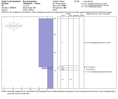
Cracking, collapsing, and remote triggering where ever so slightly wind-stiffened new snow was sitting on faceted snow from Thanksgiving storm. The fields of surface hoar that I observed in this area on 12/6 were not producing shooting cracks on collapsing.
Snow Stability
Stability Rating:
PoorConfidence in Rating:
HighStability Trend:
SteadyBottom Line
Very weak snowpack was easily overloaded by this weekend's storm. Not expecting this problem to get better quickly. This is not the type of base I was hoping to build the snowpack on this year.
Media/Attachments
Advanced Information
Weather Summary
Cloud Cover:
Partly CloudyTemperature:
Near freezingWind:
Light , NWVariably cloudy, generally clearing through the day, but lots of scrappy clouds passing through with occasional S-1 showers. Quite a bit of solar input. 40cm snow from weekend's storm
Avalanche Observations
| # | Date | Location | Size | Type | Bed Sfc | Depth | Trigger | Comments | Photo |
|---|---|---|---|---|---|---|---|---|---|
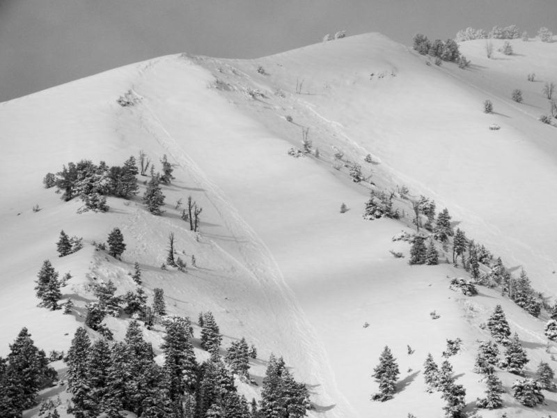
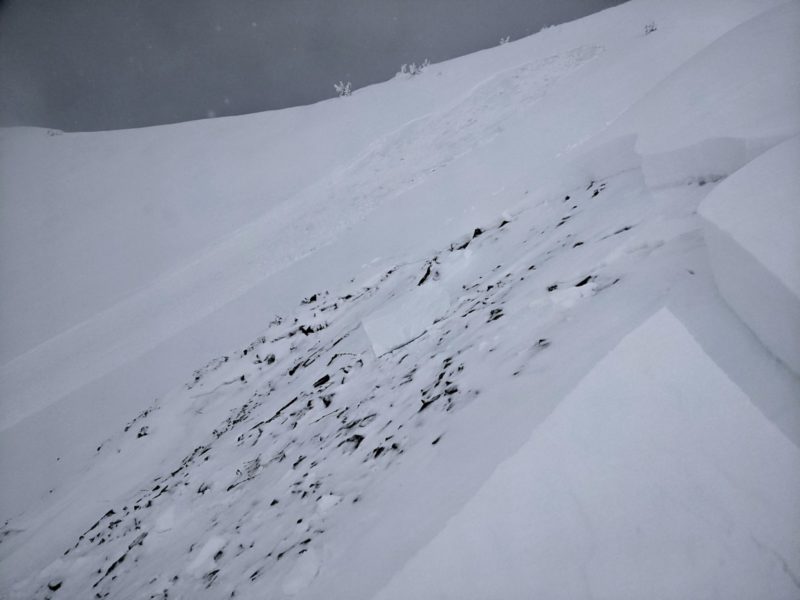
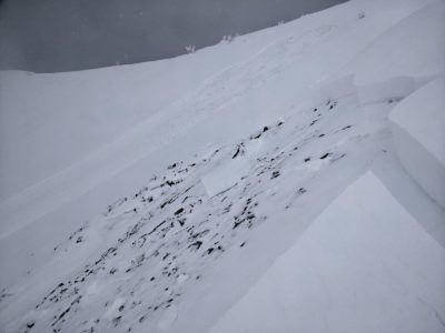
| 3 |
Eagle Creek Headwall W 9,700-10,000 |
D2 | SS | I-New/Old Interface | 30-45cm |
AS-Skier r-Remote |
Remotely triggered three pockets, 30-50m wide. Trigger distance varied from 10m to 100m. Avalanches failed on 10-15cm layer of faceted snow left over from Thanksgiving storms |
|
|
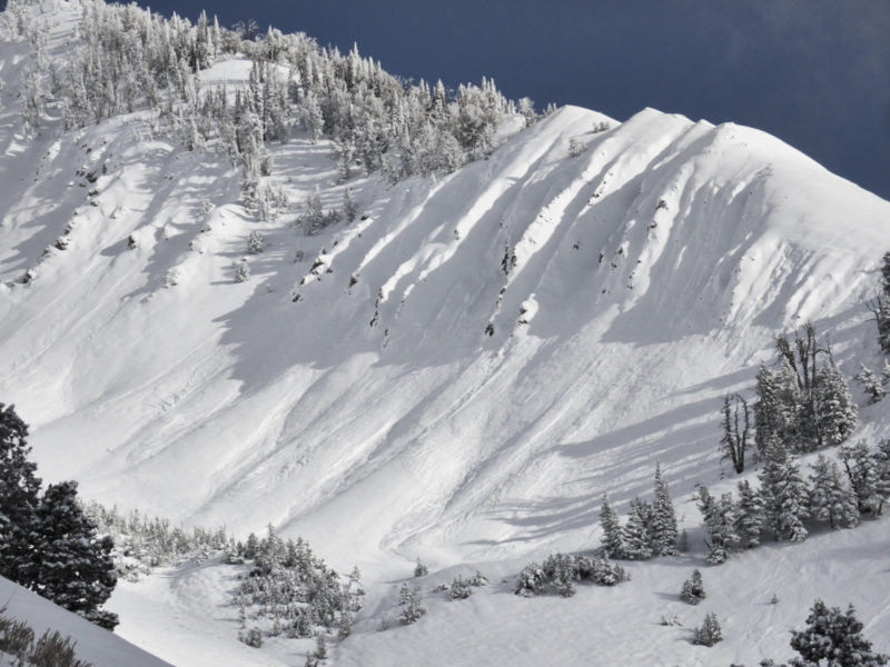
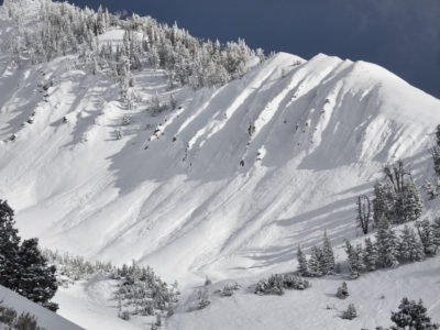
| Dozen |
Eagle Creek |
D1.5 | SS | N-Natural | Various aspects and elevations, lots of evidence of D1-D2 activity during the storm. Difficult to tell exactly what the bed surface was, some appeared to be failing on a mid-storm density inversion, others at the new/old interface (12/7) |
|
|||
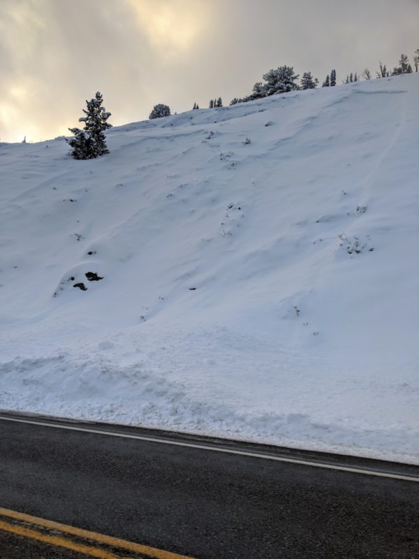
| 3 |
Galena Pass Roadcuts |
Slides in 3 or 4 locations on Galena Pass. I was driving north and didn't have time to look at crowns directly. None seemed to be deeper than the new/old interface. |

|
Snowpack Observations
Very thin layer of snow leftover from Thanksgiving storms was capable of producing remotely triggered avalanches. No snow in this area prior to Thanksgiving.
Avalanche Problems
| Problem | Location | Distribution | Sensitivity | Size | Comments |
|---|---|---|---|---|---|
 Persistent Slab
|
|
Layer Depth/Date: down 30-45cm, buried 12/7 Comments: Most sensitive on slopes without a significant sun crust (formed on due souths only) |
Terrain Use
Avoided avalanche terrain.