Basic Information
Observation Details
Observation Date:
January 30, 2020Submitted:
January 30, 2020Observer:
SAC - Lundy, MayZone or Region:
Banner SummitLocation:
Upper Bear Valley Creek, SW corner of Banner Summit ZoneSigns of Unstable Snow
Recent Avalanches?
None ObservedCracking?
None ExperiencedCollapsing?
None ExperiencedSnow Stability
Stability Rating:
GoodConfidence in Rating:
ModerateStability Trend:
SteadyBottom Line
Today's goal was primarily recon of the western reaches of the Banner Summit zone. We saw a lot of terrain, but snowpack obs come from 6500-8300' in elevation at the SW corner of the zone. Overall, the snowpack seemed very similar to the terrain closer to the highway (i.e. Copper), perhaps slightly deeper.
Advanced Information
Weather Summary
Cloud Cover:
Partly CloudyWind:
CalmSkies began FEW but high clouds increased through the day. We didn't spend much time in wind-exposed terrain, but the winds were calm on a 8300' high point.
Avalanche Observations
| # | Date | Location | Size | Type | Bed Sfc | Depth | Trigger | Comments | Photo |
|---|---|---|---|---|---|---|---|---|---|
| A few |
Head of Fir Creek NE 8800 |
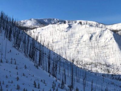
D3 | HS | O-Old Snow | N-Natural | Old deep slab is visible on the far/highest ridge. Similar to deep slabs observed elsewhere in this zone in mid January. This is approximately 5 miles from Copper. |

|
Snowpack Observations
Snowpack in this part of the zone seemed similar to the Copper area, maybe slightly deeper. Obs below are from the SW corner of the zone in upper Bear Valley Creek.
@6500' flat meadow, HS was 100cm
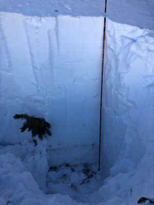
@8300, NNE (see photo below): HS 190cm. 12/7 surface hoar was barely discernible and down 150cm—good to see the old friend out here even. 11/26 was down 160cm and consisted of the common 3cm layer of 3-4mm FC on a deteriorating MFcr over 25cm of 5mm DH. It was difficult to gauge hardness of the thin FC layer above the crust, but it did seem to be gaining some strength. Still quite a hardness jump from the P slab above. The DH was a bit weaker than what I've seen in other places. The hardness was sporadic, some of it was a F as it gets, but in other areas there were significant "chunks" where it was quite stuck together—see the photo below.


Avalanche Problems
| Problem | Location | Distribution | Sensitivity | Size | Comments |
|---|---|---|---|---|---|
 Deep Persistent Slab
|
|
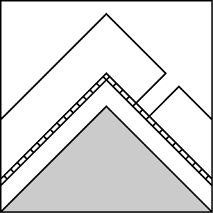
Layer Depth/Date: 150-160cm Comments: Rose is colored in based on our observations. Problem is presumed to exist at other elevations and aspects. |
Terrain Use
We made conservative decisions based on being in a remote and unfamiliar area.
