Pro Field Report
Basic Information
Observation Details
Observation Date:
February 11, 2020Submitted:
February 11, 2020Observer:
SAC - Davis, StefanZone or Region:
Banner SummitLocation:
Copper MountainSigns of Unstable Snow
Recent Avalanches?
None ObservedCracking?
IsolatedCollapsing?
None ExperiencedSnow Stability
Stability Rating:
Very GoodConfidence in Rating:
ModerateStability Trend:
SteadyBottom Line
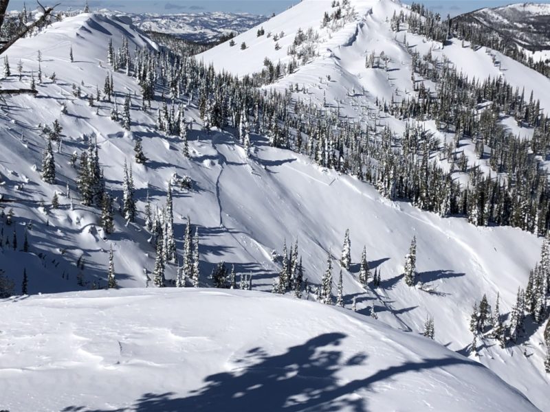
A slab avalanche was observed yesterday near Copper. We set out to determine what the slide failed on and whether the weak layer could be found in other areas.
The slide failed on an east-facing slope at 8,800’. It occurred at the tail end of the last storm (over the weekend) on a thin layer of preserved low-density snow. We also found this layering on sheltered S-facing slopes. Based on our observations today this layer currently appears to be unreactive.
Media/Attachments
Advanced Information
Weather Summary
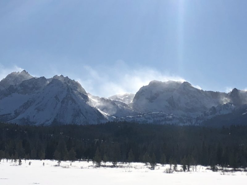
Cloud Cover:
Mostly SunnyWind:
Moderate , SWDecreasing clouds throughout the day. Warm near the road at Banner Summit (32 F) while still 16 F in Stanley at 3 PM. Wind blew light to moderate from the SW at the ridge top of Copper Mountain. Wind speeds increased throughout the day and blew around a substantial amount of snow at upper elevation in the northern Sawtooths. Wind was not moving much snow in the Southern Sawtooths or near Galena Pass.
Snowpack Observations
Surface Conditions:
Surface hoar on north-facing slopes. Breakable 3 cm crust on most S-SW-W. Generally light faceting elsewhere.
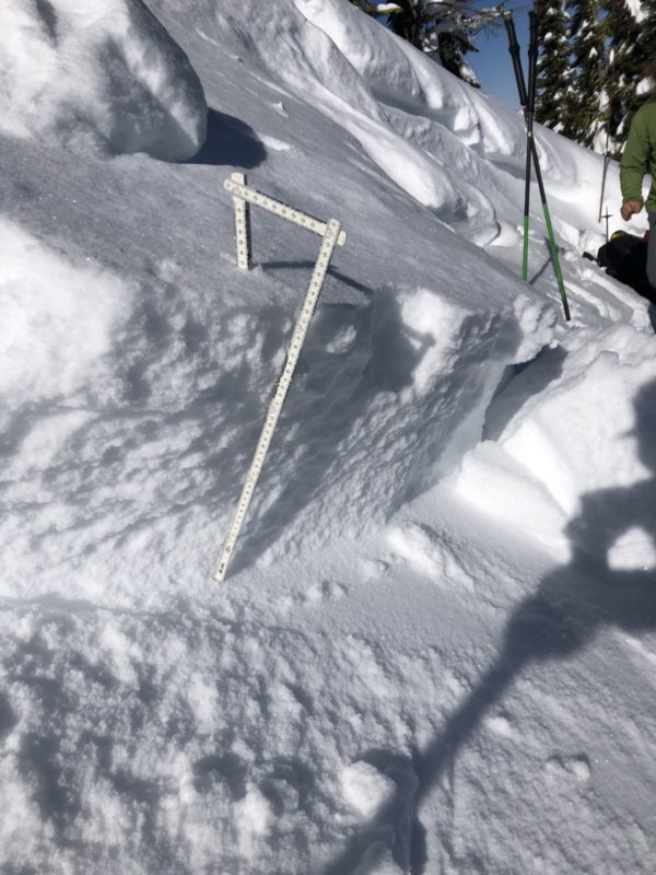
8,116’, South (170 deg.), HS 145 cm:
Martin and I both found subtle weak layers in the upper 35 cm of the snowpack. The most notable was a layer of well preserved and lightly faceted low-density snow sandwiched between layers of slightly stronger snow. This was the same layer responsible for the slide shown in the photo. CT16, ECTN down 35 cm
Avalanche Problems
| Problem | Location | Distribution | Sensitivity | Size | Comments |
|---|---|---|---|---|---|
 Wind Slab
|
|
Layer Depth/Date: 30-40 cm Comments: The recently formed wind slabs we encountered were 4F-1F. Only minor cracking. |
We did not assess weak layers near the ground.