Pro Field Report
Basic Information
Observation Details
Observation Date:
March 19, 2020Submitted:
March 19, 2020Observer:
SAC - LundyZone or Region:
Galena Summit and Eastern MtnsLocation:
Titus RidgeSigns of Unstable Snow
Recent Avalanches?
None ObservedCracking?
None ExperiencedCollapsing?
None ExperiencedSnow Stability
Stability Rating:
GoodConfidence in Rating:
HighStability Trend:
ImprovingBottom Line
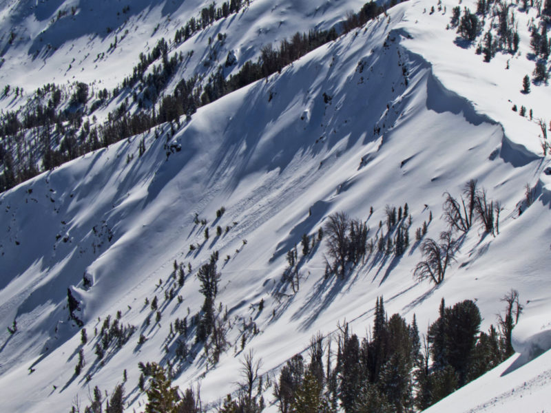
This area had 10" of settled storm snow since the weekend. It fell on a variety of surfaces—on shady/sheltered slopes there are facets beneath, but on many other slopes it's a hard crust or old wind hardened snow. There does not seem to be a widespread slab or a widespread weak layer, but both may exist in isolated spots where a wind slab sits atop an old faceted surface.
Media/Attachments
Advanced Information
Weather Summary
Cloud Cover:
Partly CloudyTemperature:
upper 20sWind:
LightCloud cover was more in the WR Valley (SCT going to BKN by afternoon) than in the Sawtooth Valley (FEW to SCT). Between a cool light wind and some clouds, it did not get as warm as expected.
Avalanche Observations
| # | Date | Location | Size | Type | Bed Sfc | Depth | Trigger | Comments | Photo |
|---|---|---|---|---|---|---|---|---|---|
| 1 |
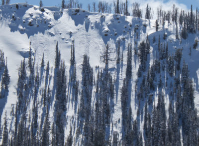
Upper Alturas NE ~9500 |
D1.5 | U | Saw some fresher looking debris from a long ways. Start zone was shadowed, but appeared to come from a wind loaded ridgeline. Unfortunately my photo ended up super blurry. | None | ||||
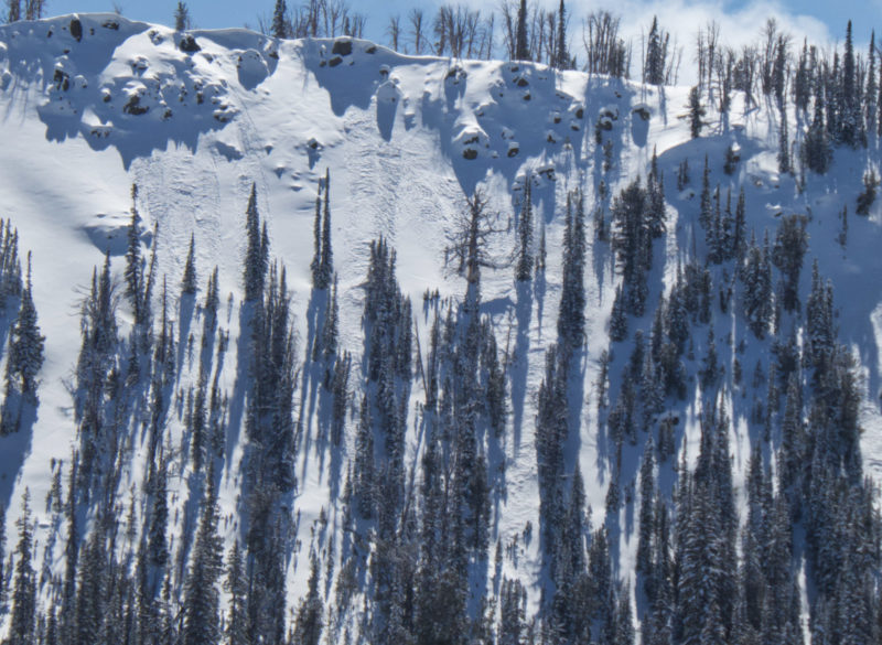
| Several |
Titus Ridge/Eds Face N 9400 |
D1 | SS | I-New/Old Interface | N-Natural | Several small slabs that ran towards the end of this past weekend's storm. |
|
Saw a few new wet loose in the Sawtooths this afternoon, but overall today's WL activity was pretty limited.
Snowpack Observations
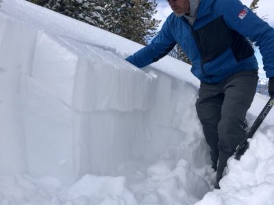
Settled storm snow since 3/14 seemed to be around 25cm at upper elevations. Slopes getting any amount of sun consist of the recent snow in various states of getting baked down onto old crusts. On shady slopes, the 3/14 interface is highly variable, ranging from wind hardened surfaces to very weak near surface facets. I dug a pit on a shady/sheltered slope (NE, 9600) where it was very obvious that the recent snow was sitting on facets. I got two ECTP6 and ECTP9 down 25cm on the 3/14 interface (see photo). Despite this result, there was very little slab (F+/4F-) and this layering seemed isolated. Hand pits in other places with wind affected snow below didn't give any clean shears.
Avalanche Problems
No wind slabs observed, seemed cool enough that the wet loose wasn't a significant issue where I was.