Pro Field Report
Basic Information
Observation Details
Observation Date:
April 8, 2020Submitted:
April 8, 2020Observer:
SAC - DavisZone or Region:
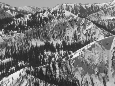
Galena Summit and Eastern MtnsLocation:
Titus Ridge and Driving in Warm Springs and E. ForkSigns of Unstable Snow
Recent Avalanches?
YesCracking?
None ExperiencedCollapsing?
None ExperiencedSnow Stability
Stability Rating:
PoorConfidence in Rating:
HighStability Trend:
SteadyBottom Line
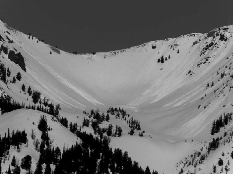
The upper 1-2 feet of recent snow is in various stages of succumbing to warm temps and intense spring sun. I think the majority (but not all) of the sun-induced, shallower "peeling" flavor of wet loose avalanche activity will have run its course today.
Temperatures are expected to increase tomorrow and remain elevated Friday. With weaker overnight freezes and continued warm temperatures, I'd expect to see potentially fewer but larger wet loose avalanches as meltwater makes its way deeper into the snowpack. More unpredictable is what sort of slab avalanche activity this may cause as the slab and weak layer properties quickly change. It seems the next couple of days are good candidates for some interesting slab avalanches as well.
Media/Attachments
Advanced Information
Weather Summary
Cloud Cover:
Mostly SunnyTemperature:
48-50 FWind:
Light , WVery warm and sunny. Light W and WNW wind kept things a bit cooler on exposed ridges.
Avalanche Observations
| # | Date | Location | Size | Type | Bed Sfc | Depth | Trigger | Comments | Photo |
|---|---|---|---|---|---|---|---|---|---|
| Several Dozen |
Boulders, Smokys, W. Smokys Middle and Upper |
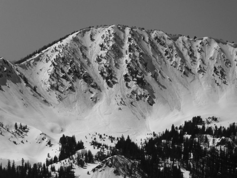
D1.5 | WL | Many, many dozens of wet loose avalanches on several aspects maybe excluding only true N and NE at upper elevation. Many of these ran yesterday or during periods of sun on Monday afternoon. There were also several very fresh looking slides that I don't believe were visible on my way up the pass, but were quite obvious as I left after 4 PM. |

|
||||
| Dozens |
Headwaters, Frenchmans and Smiley Creek |
D2 | SS | Looking through my pictures, there were dozens of slab avalanches on primarily E-NE and N facing slopes (based on my vantage point). Several were at middle elevation. None of the slides looked particularly crisp and I assume most ran during the storm at the beginning of the month. |
|
||||
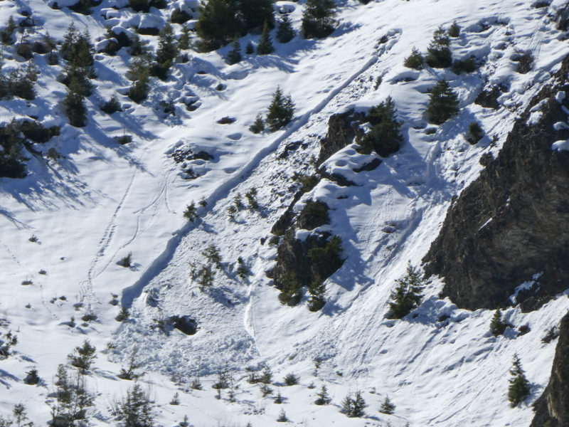
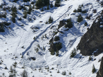
| 1 |
E. Fork of the Big Wood NE 6,500 |
D1.5 | WL | Wet loose that gouged to the ground. I'm assuming this ran during warm weather and rain on Monday afternoon. It does, however, point to the potential for more of these types of slides in the next two days with extremely warm weather and mild overnight low temperatures. |
|
Snowpack Observations
Titus Ridge:
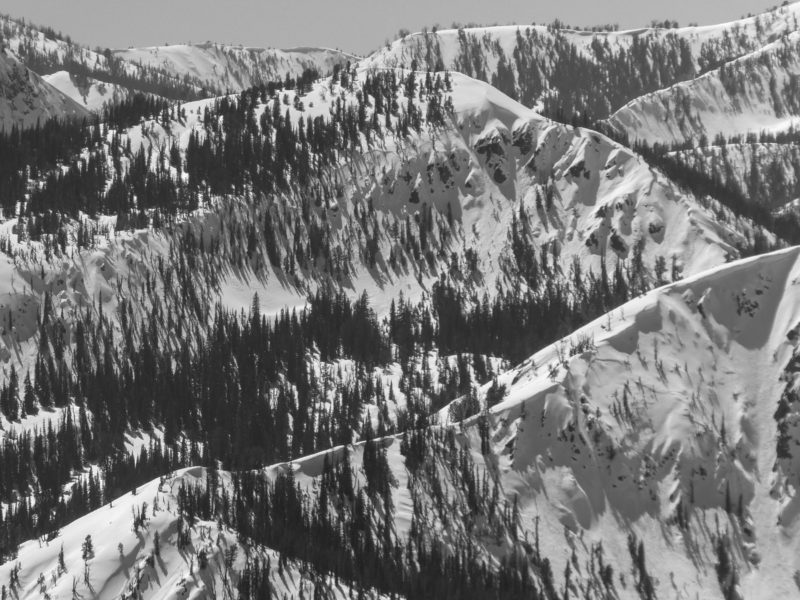
Surface hoar (0.5-1 cm) was present on many shaded aspects or lower angle sunny slopes along Titus Ridge. The height of snow varied from 90-190 cm based on the aspect. I found anywhere from 1 to 3 crusts in the upper 40 cm based on the aspect (more on sunnier slopes). These crusts did not produce propagating results (ECTNs) where I checked on a NNW facing slope at 9,600'.
The snow surface was wet or on the way to getting wet everywhere that I looked aside from upper elevation N and possibly NE facing slopes. Crusts near the snow surface were broken down or in the process of breaking down and the upper 10 cm was moist/wet on many aspects. Between 10-40 cm down the snow was moist in some areas and was still dry in others. Another crust about (40 cm down) was still fairly strong everywhere I looked.
Avalanche Problems
| Problem | Location | Distribution | Sensitivity | Size | Comments |
|---|---|---|---|---|---|
 Persistent Slab
|
|
Comments: Based on the avalanches I saw in the W. Smokys and Boulders and those reported in recent days. |
|||
 Wet Loose
|
|
Comments: Tons of activity since Monday afternoon. A good portion of it appeared to occur today. I imagine most (but not all) of the shallower "easy pickens" have been stripped from the obvious locations. Middle and lower elevation slopes (particularly those that got direct sun) were in various stages of glop. |
Terrain Use
I closed all avalanche terrain.