Pro Field Report
Basic Information
Observation Details
Observation Date:
December 26, 2020Submitted:
December 26, 2020Observer:
SAC - Chris LundyZone or Region:
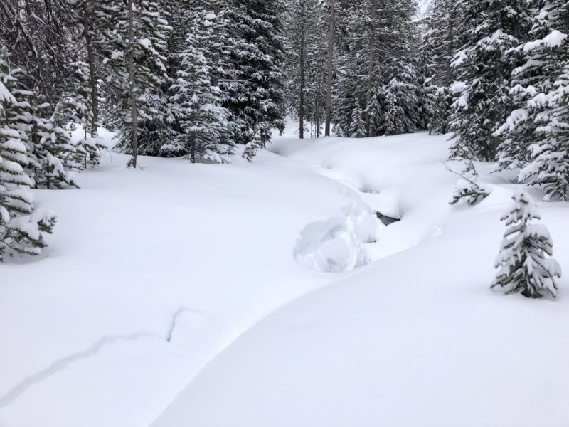
Galena Summit and Eastern MtnsLocation:
4th of July Lake (9000-9700', N-W)Signs of Unstable Snow
Recent Avalanches?
None ObservedCracking?
IsolatedCollapsing?
IsolatedSnow Stability
Stability Rating:
FairConfidence in Rating:
HighStability Trend:
WorseningBottom Line
New snowfall is continuing to slowly load our buried facet layer. Instability is not yet widespread, but I'm fairly certain you could have triggered a slide on many steep slopes with the right characteristics: wind-stiffened slab over the facet layer.
Media/Attachments
Advanced Information
Weather Summary
Cloud Cover:
ObscuredWind:
LightThe storm looked like it was breaking up late morning, only to come back harder around noon. From noon to when I left the field around 2pm, it was snowing S1-2. New snow in this area seemed to be around 15cm.
Avalanche Observations
Visibility wasn't great and light was flat, but I did see a fair bit of avalanche terrain and I did not see any slides.
Snowpack Observations
The storm from earlier this week (12/20) appears to have been much colder in the White Clouds. There was no sign of a rain crust, even at mid-elevations, and the recent storm snow was much softer. Quite a dramatic difference from other place's I've seen. Shot in the dark, but storm totals from 12/20 storm were likely similar to Galena Summit.
The result of this difference is that the slab atop the 12/11 layer is still very soft (F to F+) and with today's storm, averages about 40cm thick. On sheltered slopes, the slab was soft enough that skis penetrated through the slab making trail-breaking tough. On a sled, I was leaving a 60cm trench.
I did remotely "trigger" some cracking/sliding along a short/steep creek bank. I looked for SH but did not find any, it was breaking on the 12/11 FC.
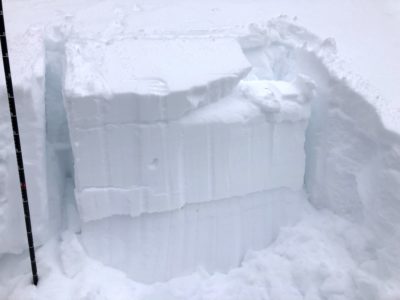
@9500', N, 20*: sheltered location in tree opening. HS 100-105cm. 40-45cm slab, F+ at base, over F 12/11 FC. ECTX x2 - slab just seemed too soft. Basal facets present in this area, but showing some sign of strengthening and were 1F to 4F.
@9700', N: exposed slope near treeline. Slab 40cm and slightly stiffer (4F at base) - which made all the difference. ECTP13 & 15, see photo below.
A very faint crust could be felt beneath the new snow from yesterday evening's freezing rain.
Avalanche Problems
| Problem | Location | Distribution | Sensitivity | Size | Comments |
|---|---|---|---|---|---|
 Persistent Slab
|
|
Layer Depth/Date: 40cm Weak Layer(s): Dec 11, 2020 (FCsf) Comments: Sensitivity is reactive where a slightly stiffer slab exists. |
I did not get into exposed terrain to assess wind loading.
Terrain Use
I avoided avalanche terrain, including runout zones.