Pro Field Report
Basic Information
Observation Details
Observation Date:
January 28, 2021Submitted:
January 28, 2021Observer:
SAC - Chris LundyZone or Region:
Galena Summit and Eastern MtnsLocation:
Titus Ridge, driving Stanley to Ketchum (8700-9900, SE-E-NE-NW)Signs of Unstable Snow
Recent Avalanches?
YesCracking?
IsolatedCollapsing?
IsolatedSnow Stability
Stability Rating:
PoorConfidence in Rating:
HighStability Trend:
WorseningBottom Line
20” of new snow (and still falling) and strong winds are overloading a weak snowpack.
Media/Attachments
Advanced Information
Weather Summary
Cloud Cover:
ObscuredTemperature:
High teens (est)Wind:
Moderate , SENew/Recent Snowfall:
50cm+ on old hard surfaces as of 1400. HN is still low density in the few places where it's not wind-affected.Snowing and blowing. Snowfall increased significantly as I approached Smiley Cr this morning and especially as I went up the pass. S1-2 while I was in the field or driving, from 1000-1500. Winds were MOD gusting STRONG. The snowfall and wind had tapered off significantly on my return trip over the pass at 1800.
Avalanche Observations
| # | Date | Location | Size | Type | Bed Sfc | Depth | Trigger | Photos | Details |
|---|---|---|---|---|---|---|---|---|---|
| 1 |
Jan 28, 2021 (Exact) |
Titus Lake Chutes NE 9900ft |
D2 |
AS-Skier r-Remote |
|
Report |
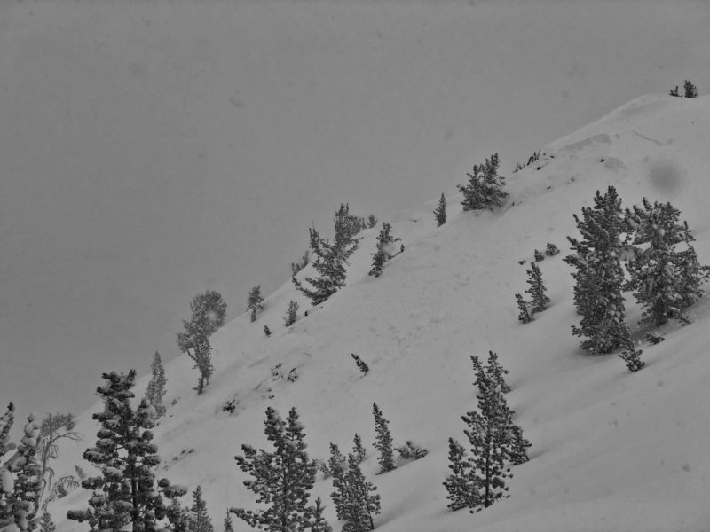
There were several thin/small storm slabs on Titus Ridge and on steep slopes above the highway.
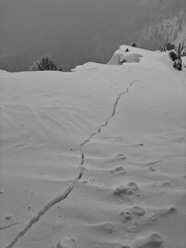
Stomping around on the steep slopes off the First Bump that drain back towards the hairpin, a slope collapsed and cracked and small section where it was steeper and more wind-loaded avalanched. The cracking was down to the facets, but I'm unsure about the section that released (D1-1.5). See photo.
I'm nearly positive I remoted a D2 in the Lake Chutes just below the Peak above Titus Lake. I'm fairly certain it wasn't there on the hike up. It looks to have released on 12/11, but didn't break as wide as it seems like it could have. See photo. I'll add these slides to the Avy DB tomorrow.
Surprisingly, I didn't see any naturals on the steep slopes above the highway or nordic trail near Owl/Prairie creek, north of Baker Creek, etc.
Snowpack Observations
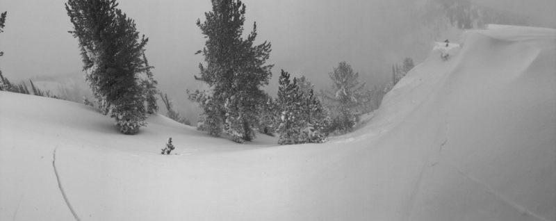
SE Wind has scoured most of the Titus Ridge start zones unless they’re due N. Significant drifting along the ridge to 1m+ in depth. There seemed to be a minor mid-storm interface in the top 30cm but this is likely to settle out quickly. I stomped around above steeper terrain in Timber Bowl with no results.
Avalanche Problems
| Problem | Location | Distribution | Sensitivity | Size | Comments |
|---|---|---|---|---|---|
 Persistent Slab
|
|
Layer Depth/Date: 90cm Weak Layer(s): Dec 11, 2020 (FCsf) Comments: Rose indicates observed terrain. |
|||
 Wind Slab
|
|
Layer Depth/Date: 60-100cm Comments: Rose may be exaggerated, but I saw wind drifts at all elevations on the drive. |
Terrain Use
I stayed on the ridge and avoided all avalanche terrain.