Pro Field Report
Basic Information
Observation Details
Observation Date:
January 30, 2021Submitted:
January 30, 2021Observer:
SAC - Chris LundyZone or Region:
Galena Summit and Eastern MtnsLocation:
Driving from Stanley to north of KetchumSigns of Unstable Snow
Recent Avalanches?
YesCracking?
None ExperiencedCollapsing?
None ExperiencedSnow Stability
Stability Rating:
PoorConfidence in Rating:
HighStability Trend:
SteadyBottom Line
The recent storm produced an extensive avalanche cycle. Avalanches become more numerous the closer you get to the Wood River Valley.
Media/Attachments
Advanced Information
Weather Summary
Cloud Cover:
Mostly CloudyTemperature:
20 F at pass level, 30 F in valleySkies were generally broken, except as you approached the WRV where they became scattered.
Avalanche Observations
| # | Date | Location | Size | Type | Bed Sfc | Depth | Trigger | Photos | Details |
|---|---|---|---|---|---|---|---|---|---|
| 8 |
Jan 29, 2021 (+/- 1 day) |
Durrance E ft |
D2 | N-Natural |
|
Report | |||
| 1 |
Jan 29, 2021 (+/- 1 day) |
Owl Creek SE 9700ft |
D2 | N-Natural |
|
Report | |||
| 1 |
Jan 29, 2021 (+/- 1 day) |
Anderson Creek E 9600ft |
D2 | N-Natural |
|
Report | |||
| 5 |
Jan 29, 2021 (+/- 1 day) |
Triple Peak NW 8000ft |
D2 | N-Natural |
|
Report | |||
| 12 |
Jan 29, 2021 (+/- 1 day) |
Eagle/Lake Creek Ridgeline NW 9000ft |
D2 | N-Natural |
|
Report | |||
| 12 |
Jan 29, 2021 (+/- 1 day) |
Murdock Creek ("Chickens Foot" Ridgeline) NW ft |
D2 | SS-Soft Slab | N-Natural |
|
Report | ||
| 1 |
Jan 29, 2021 (+/- 1 day) |
Mid-elevation terrain in Gladiator Cr W 8400ft |
D2 | N-Natural | Report | ||||
| 1 |
Jan 28, 2021 (+/- 1 day) |
Timber Bowl - Lookers Right side NW 9300ft |
D2 | U-Unknown | Report | ||||
| 6 |
Jan 28, 2021 (+/- 1 day) |
Mid elevations, Smiley Creek area E ft |
D1.5 | SS-Soft Slab | N-Natural |
|
Report | ||
| 1 |
Jan 28, 2021 (+/- 1 day) |
Sawmill Canyon NE 10100ft |
D3 | O-Old Snow | N-Natural |
|
Report | ||
| 1 |
Jan 28, 2021 (+/- 1 day) |
Cabin Peak E 9900ft |
D2.5 | SS-Soft Slab | N-Natural |
|
Report | ||
| 1 |
Jan 28, 2021 (+/- 3 days) |
Near McDonald Peak E 9500ft |
D1.5 | SS-Soft Slab | N-Natural |
|
Report |
Avalanche occurrences will be entered soon.
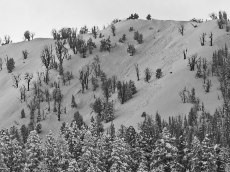
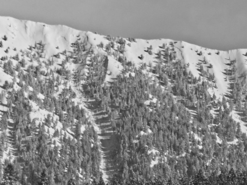
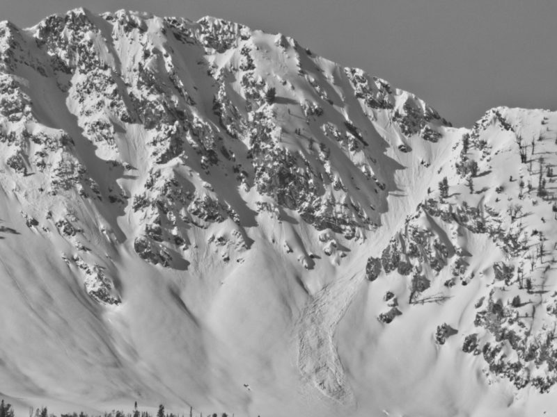
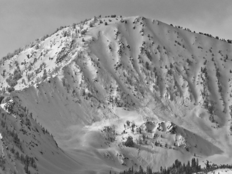
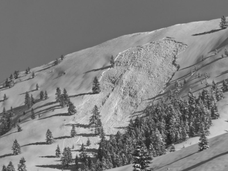
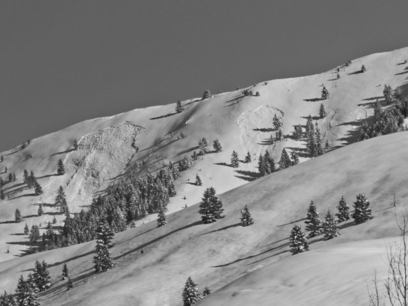
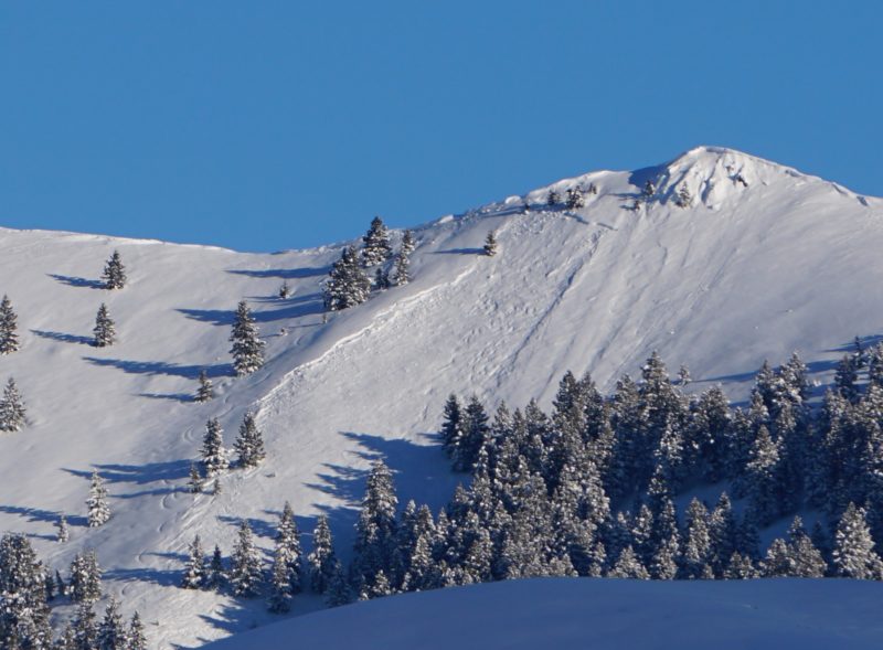
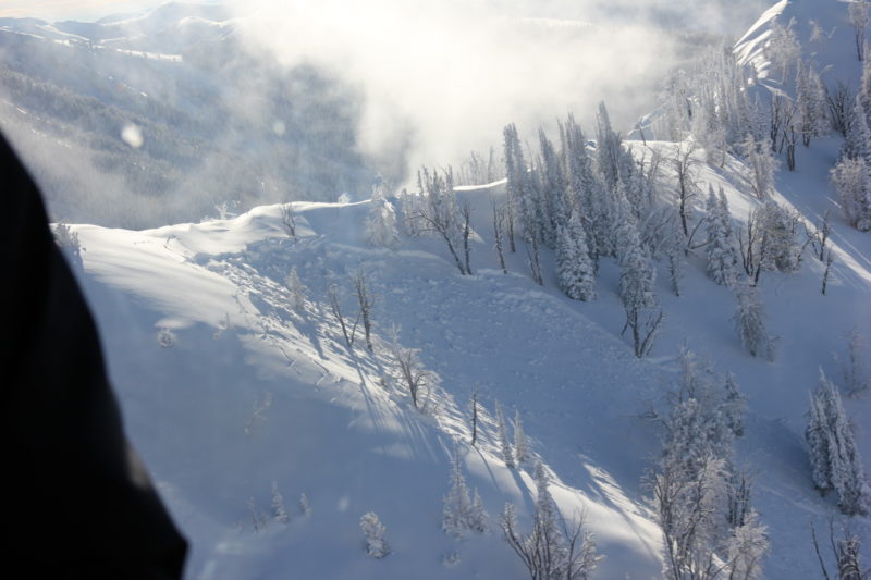
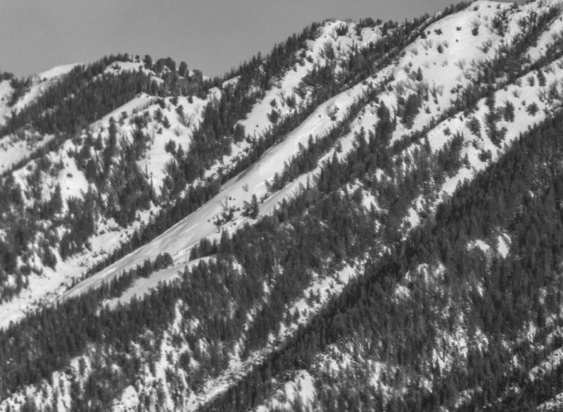
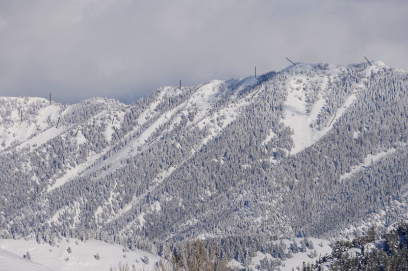
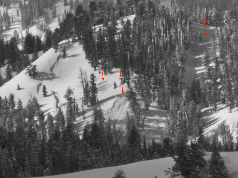
I had poor visibility of the Sawtooths on both the out and back. The terrain I did see was fairly quiet. The most notable slide was a large persistent slab on the peak at the head of Cabin Cr in the southern Sawtooths.
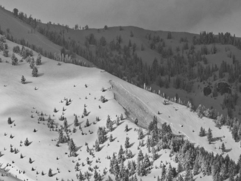
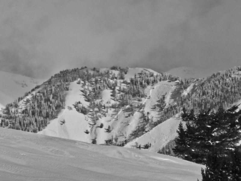
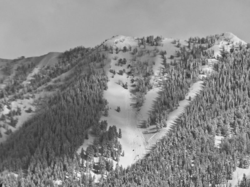
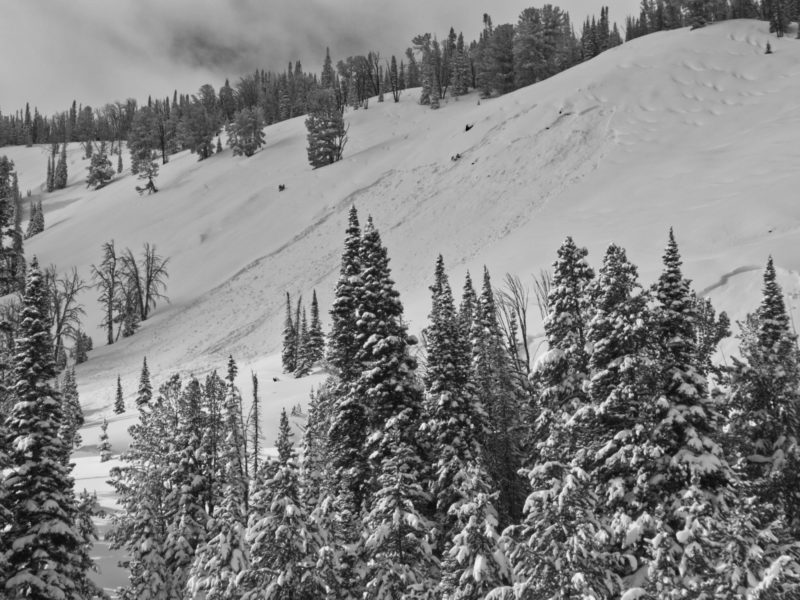
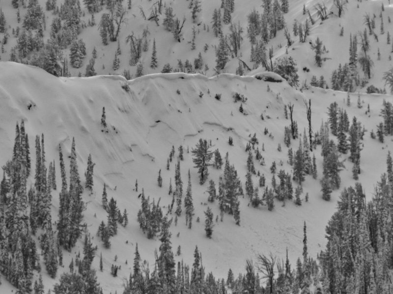
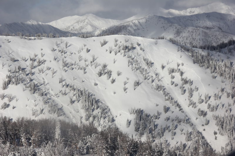
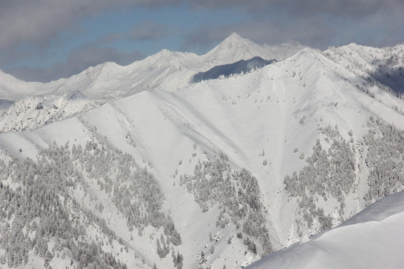
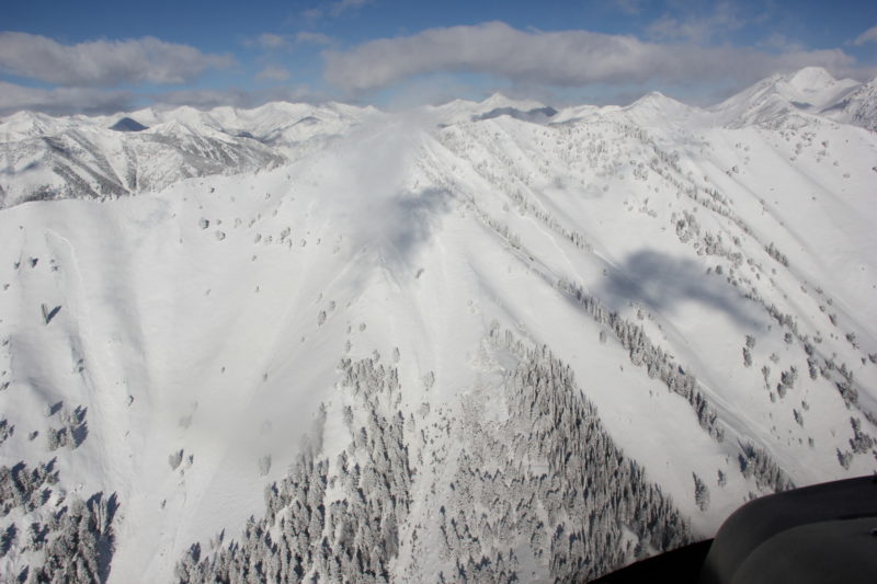
I had fair visibility of the mountains near Smiley Creek. There were a couple of large persistent slabs and a handful of smaller mid-elevation slides. The visibility in the Smokys from Galena Summit to Baker Creek was hit or miss. I saw at least a couple of large persistent slabs in addition to the ones near Titus Ridge already reported.
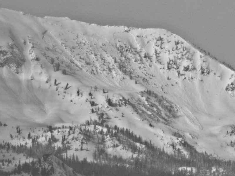
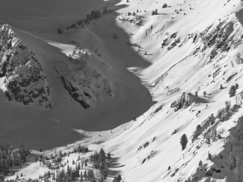
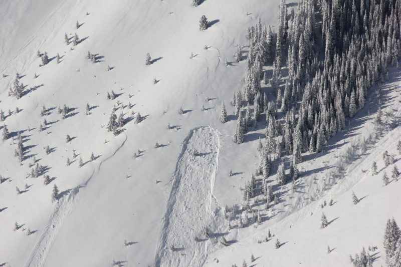
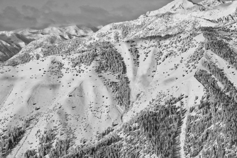
It's no surprise that the avalanche activity was much more extensive south of the SNRA headquarters where the snowpack was weaker and the storm stronger. There were numerous, large persistent slabs on Durrance, in Murdock and Eagle Creek, and on Triple Peak.
Snowpack Observations
Closer to the Wood River Valley, the slab depth seemed more uniform although I'm uncertain whether it's the old snow surface (1/26) or the older facets (12/11). Further north, slab depth was more variable and the failure layer is more difficult to guess. At least some of the slides appear to be breaking on persistent weak layers above 12/11.