Pro Field Report
Basic Information
Observation Details
Observation Date:
December 1, 2022Submitted:
December 1, 2022Observer:
SAC - Lundy, LeideckerZone or Region:
Galena Summit and Eastern MtnsLocation:
Cross (rec tour) (8500-9200', E & NW)Signs of Unstable Snow
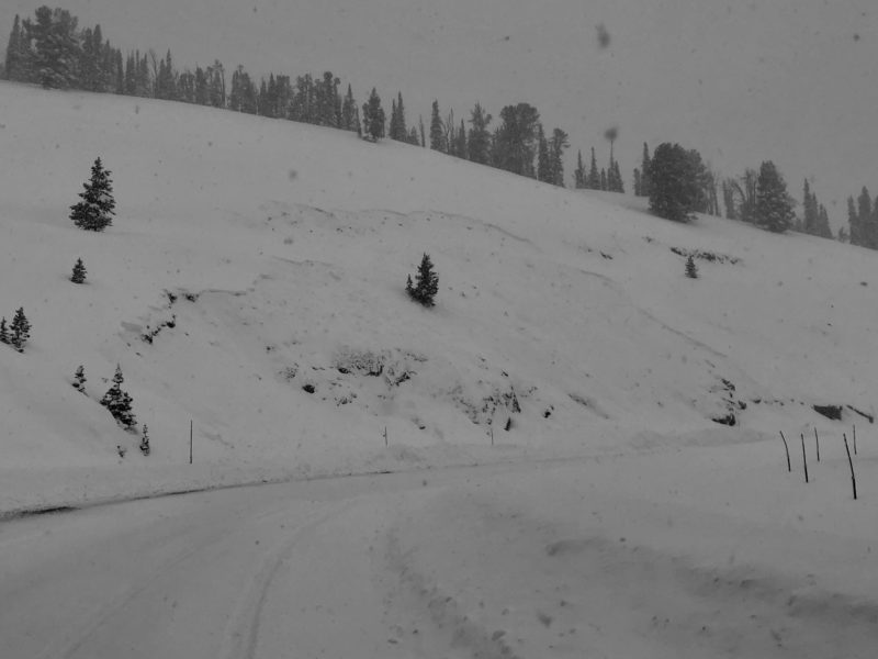
Recent Avalanches?
YesCracking?
IsolatedCollapsing?
IsolatedSnow Stability
Stability Rating:
PoorConfidence in Rating:
HighStability Trend:
SteadyBottom Line
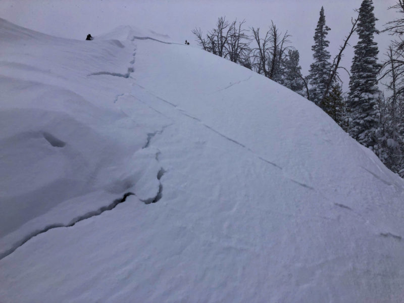
Loading from new snow and wind is overloading an exceptionally weak snowpack. Slope >35* with any wind effect/stiffening seemed likely to slide. Wind-sheltered slopes had less of a cohesive slab, but would likely slide on slopes approaching 40 degrees.
Media/Attachments
Advanced Information
Weather Summary
Cloud Cover:
ObscuredWind:
Moderate , SNew/Recent Snowfall:
50-60cm storm total on the 11/27 interfaceHST was fairly low density and did not seem particularly inverted. The wind was affecting open, mid-elevation terrain leading to a slightly stiffened surface. Significant amounts of snow was being drifted along exposed ridgelines, with drifts in excess fo 60cm observed. S1-2 throughout our tour from 1200 to 1600.
Avalanche Observations
| # | Date | Location | Size | Type | Bed Sfc | Depth | Trigger | Photos | Details |
|---|---|---|---|---|---|---|---|---|---|
| 2 |
Dec 1, 2022 (Exact) |
Above Hwy 75 between Titus Lake TH and top of Galena Summit SE 8800ft |
D1.5 | SS-Soft Slab | O-Old Snow | 1.5ft | U-Unknown |
|
Report |
| # | Date | Location | Size | Type | Bed Sfc | Depth | Trigger | Comments | Photo |
|---|---|---|---|---|---|---|---|---|---|
| 5 |
Road cuts above highway 75, especially below and above the highway uphill from Camp Cr hairpin NW 8300 |
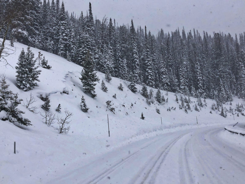
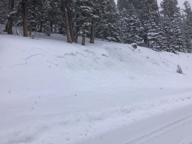
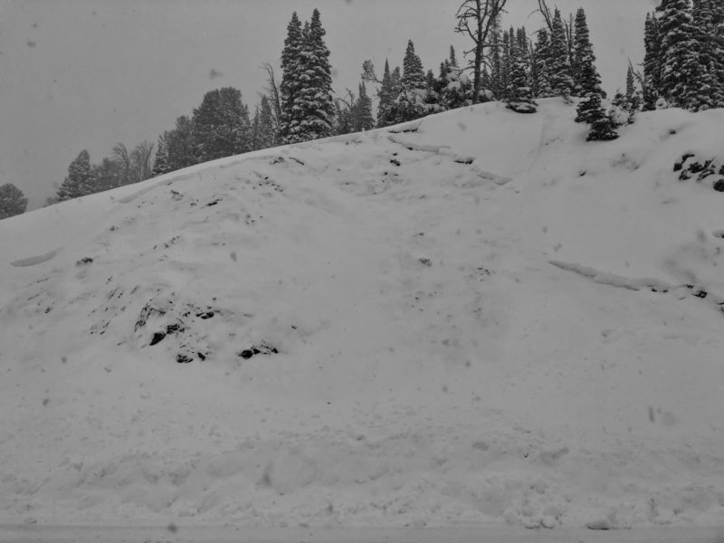
D1 | SS | O-Old Snow | 40-50cm (est) | Unknown if plow triggered or natural | None |
No visibility of upper elevation terrain.
Snowpack Observations
New snow on wind-sheltered slopes was generally low-density and right-side up (except for weak facets below).
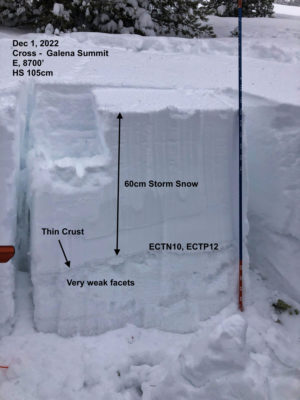
@8700', E: HS 100cm. HST 55cm. Base of HST was F+. 11/27 presented as thin/deteriorated/soft crust with some perc channels below it atop 40cm of F FC going to 4F at the ground. ECTN10 and ECTP11 on 11/27.
@8800, NW: HS 105cm. HST 55cm. 11/27 interface to ground was completely faceted, ranging from F at 11/27 interface to ~4F at ground. ECTP11.
We only observed cracking in wind-affected terrain, where it was widespread.
Avalanche Problems
| Problem | Location | Distribution | Sensitivity | Size | Comments |
|---|---|---|---|---|---|
 Persistent Slab
|
|
Layer Depth/Date: 55cm Weak Layer(s): Nov 27, 2022 (FC) Comments: Rose indicates terrain where we directly observed the problem. |
Terrain Use
We avoided avalanche terrain