Pro Field Report
Basic Information
Observation Details
Observation Date:
December 14, 2019Submitted:
December 15, 2019Observer:
SAC - VandenBosZone or Region:
Sawtooth and Western Smoky MtnsLocation:
Headwaters to SmokySigns of Unstable Snow
Recent Avalanches?
YesCracking?
WidespreadCollapsing?
WidespreadSnow Stability
Stability Rating:
PoorConfidence in Rating:
Stability Trend:
SteadyBottom Line
Continued cracking, collapsing, and remote triggering are clear indicators that avalanche hazard will not be decreasing quickly. Snowpack is complex, with several different surface hoar layers, crusts with facets, and depth hoar near the ground. Additional loading will reactivate this problem easily.
Media/Attachments
Advanced Information
Weather Summary
Cloud Cover:
Mostly SunnyWind:
Moderate , NOccasional S-1 flurries through the day with no significant accumulation. 2cm overnight based on sled tracks from yesterday. Wet north wind blowing steady moderate in upper elevations, transporting small amounts of snow.
Avalanche Observations
| # | Date | Location | Size | Type | Bed Sfc | Depth | Trigger | Comments | Photo |
|---|---|---|---|---|---|---|---|---|---|
| Several |
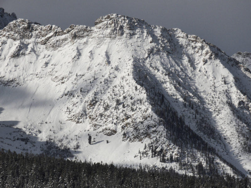
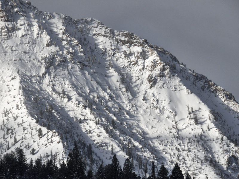
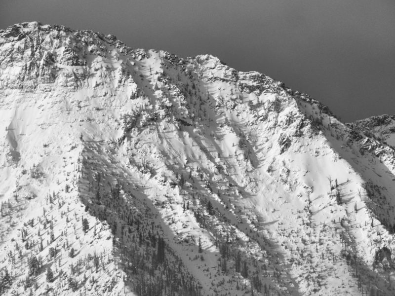
X, Meadow Bowl 8,500-9,200' |
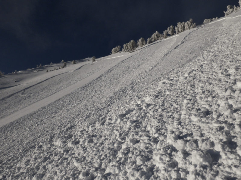
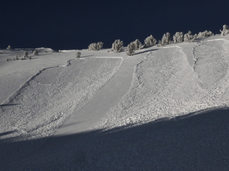
D2.5 | SS | O-Old Snow | N-Natural | NE-SE aspects, several different crowns visible, based on depth most seemed to be activating 12/7 interface, but some deeper portions may have been picking off weak snow at 11/26. These layers are pretty close together in the Sawtooths, so it may just be heavy wind loading that was causing differing crown depths. Low certainty. | None | ||
| 1 |
N face Williams apron N |
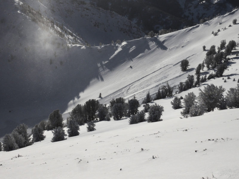
Deeper crown in heavily spindrift loaded location below N face of Williams. Could not see much glassing. | None | ||||||
| 1 |
NE 9,500 |
D2 | SS | O-Old Snow | 40-60cm |
AS-Skier r-Remote |
Triggered from ridgeline above, 100-150m away along slope | None | |
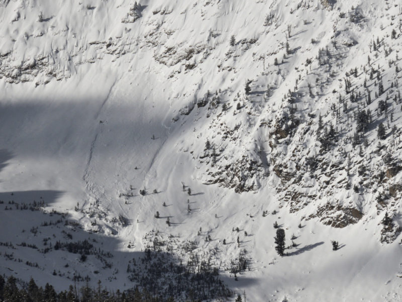
| cluster of 3 |
Blind canyon S |
D2 | SS | O-Old Snow |
AS-Skier r-Remote |
S-SE aspect. Triggered from ridgeline above, 100-150m away along slope. Failed on top of MFcr with facets. I was able to find some SH grains here as well, but not enough to convince myself that it was a primary culprit. Slab was wind stiffened, approaching 1F+ hardness in places | None |
Surprising lack of natural activity in the Smokys, particularly given how touchy the snowpack appears to be. I could find a few smaller piles of mid-storm debris below obvious paths (D2 estimated based on debris) but less than I expected. Sawtooths look like they put on a show, based on brief glassing from highway. Would be interested in looking at crowns and seeing what the culprit in the upper pack was. I found plenty of SH buried at 12/7 interface when I was there 12/10, and plenty of (then) unburried
Avalanche Problems
| Problem | Location | Distribution | Sensitivity | Size | Comments |
|---|---|---|---|---|---|
 Persistent Slab
|
|
Layer Depth/Date: 12/7 down 40-60cm Comments: SH and FCsf buried on 12/7. With our without a crust, depending on aspect. |
Terrain Use
Avoided avalanche terrain that had not already avalanched. Avoided runouts below avalanche paths that could be triggered remotely.