Pro Field Report
Basic Information
Observation Details
Observation Date:
December 17, 2019Submitted:
December 17, 2019Observer:
SAC - Davis, StefanZone or Region:
Soldier and Wood River Valley MtnsLocation:
Indian Creek - EtnaSigns of Unstable Snow
Recent Avalanches?
None ObservedCracking?
IsolatedCollapsing?
IsolatedSnow Stability
Stability Rating:
GoodConfidence in Rating:
HighStability Trend:
SteadyBottom Line
We were more concerned with shallow snow hazards than avalanche concerns. The only signs of instability we encountered were very isolated persistent slabs in previously wind-affected terrain.
Basically, there is a bunch of really weak, shallow snow out here. I'd expect avalanches with any decent load of new snow. The main layers to watch will be the 12/7 surface hoar on the aspects noted below, as well as a likely touchy interface at the current snow surface. SW-S-SE aspects are mainly dirt or the snow is shallow enough that we're not likely to see a well-connected weak layer.
Media/Attachments

Advanced Information
Weather Summary
Cloud Cover:
ClearWind:
LightClear skies with light and intermittent wind. Inverted temperatures. Below freezing at the car and guessing near 20F by 7500'.
Snowpack Observations
Current Surface:
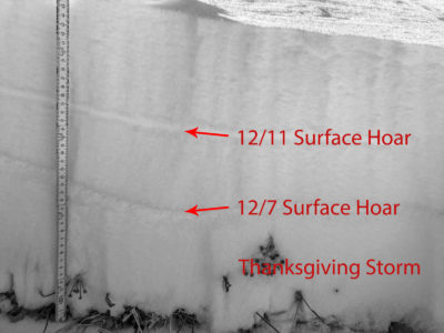
Generally, trashed facets and surface hoar. Surface hoar in shaded and sheltered NW-N-NE from 6-7500'. Not found above.
12/11 Facets and Surface Hoar:
Also more prominent in shaded NW-N-NE. Fist slab above and below. This layer doesn't seem to be a likely player with future storms.
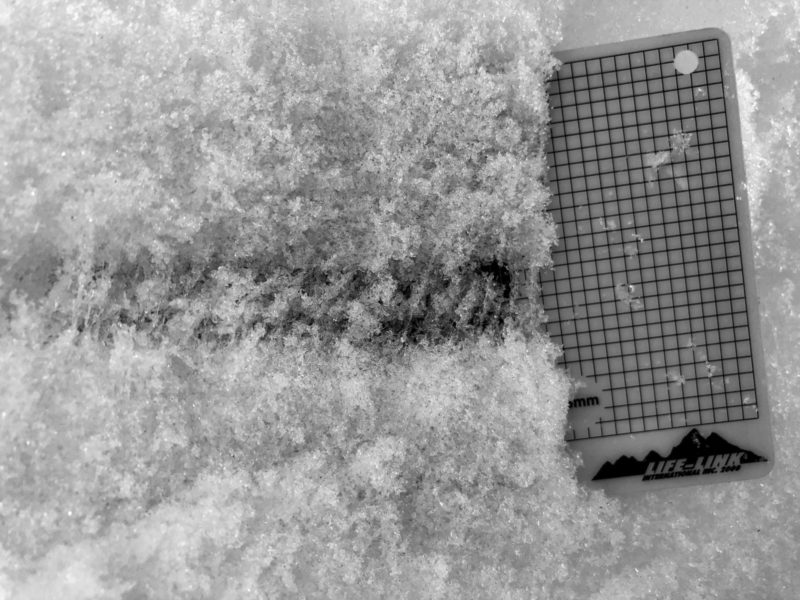
12/7 Surface Hoar and Facets (pictured):
This is the layer to watch in this zone. It presented as surface hoar up to 1.5 cm but also as a stripe of near-surface facets on W-aspects.
Pre-Thanksgiving Snow:
We did find pre-TG snow here. The old depth hoar was welded into a MFcr at the ground. Not a concern.

Avalanche Problems
| Problem | Location | Distribution | Sensitivity | Size | Comments |
|---|---|---|---|---|---|
 Persistent Slab
|
|
Layer Depth/Date: 12/7 Comments: This is currently only a concern in very isolated, previously wind-loaded locations. I added it here as the primary layer to watch with any additional loading. |
Terrain Use
We made run selections based more on coverage than avalanche concerns.