Pro Field Report
Basic Information
Observation Details
Observation Date:
March 5, 2020Submitted:
March 5, 2020Observer:
SAC - Lundy, Stefan (off duty)Zone or Region:
Banner SummitLocation:
Cape Horn/LolaSigns of Unstable Snow
Recent Avalanches?
YesCracking?
None ExperiencedCollapsing?
None ExperiencedSnow Stability
Stability Rating:
Very GoodConfidence in Rating:
HighStability Trend:
SteadyBottom Line
Generally stable snowpack with fairly typical/predictable wet loose problem on steep, solar aspects at all elevations. Wet loose slides seem unlikely to gouge down deeper than 20-30cm except (maybe) in very isolated, rocky areas where the snowpack may be unusually weak and shallow.
Media/Attachments

Advanced Information
Weather Summary
Cloud Cover:
Partly CloudyWind:
Light , STemps were very warm. Some scattered high, thin clouds didn't do much to block solar radiation. Winds were gusty at ridge level, bumping into the moderate range at times.
Avalanche Observations
| # | Date | Location | Size | Type | Bed Sfc | Depth | Trigger | Comments | Photo |
|---|---|---|---|---|---|---|---|---|---|
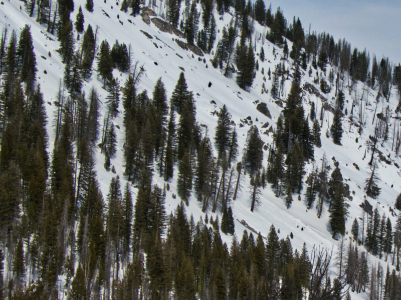
| 3-4 |
Copper W 7400 |
D1 | WL | N-Natural | These seemed significant since they were on a W (almost a hair N of W) aspect. Pretty sure these happened yesterday afternoon. Ben and Scott were in the area on Tuesday and didn't report them. |

|
|||
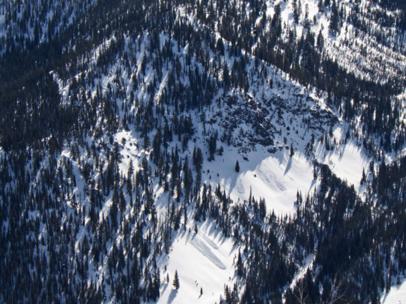
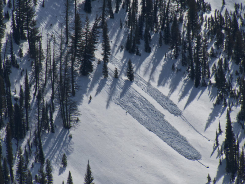
| 3-5 |
Cape Horn and Lola S mid to upper |
D1 | WL | N-Natural | Hard to pin down date but at least a few looked within past 48hrs. Also see photos below. |
|
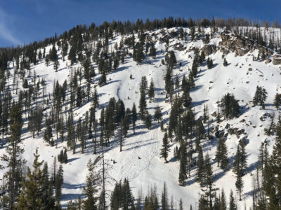
We observed a fair bit of steep, rocky, solar terrain that had no WL activity. Did not see any activity in the Stanley foothills.
Snowpack Observations
Mid to upper elevation shadys were the usual mixed bag of wind effect and FCsf. The FCsf up high has been inhibited by wind effect and is much more pronounced at low to mid-elevations. Low and mid-elevation shady aspects were pretty sticky in the trees but cold and dry in the open.
We skied a low elevation SE aspect at 1630 and while the whole snowpack was moist, only the top 15-20cm was wet. If you'd been pushing on something ~40 degrees or more, I think you could have peeled off the surface layer but I doubt it would have gouged deeper.
Avalanche Problems
| Problem | Location | Distribution | Sensitivity | Size | Comments |
|---|---|---|---|---|---|
 Wet Loose
|
|
Terrain Use
We didn't have any terrain closed except steep solars late in the day, and didn't observe anything that would have changed that plan.