Pro Field Report
Basic Information
Observation Details
Observation Date:
March 10, 2020Submitted:
March 10, 2020Observer:
SAC - DavisZone or Region:
Soldier and Wood River Valley MtnsLocation:
E. Fork Baker - Fox PeakSigns of Unstable Snow
Recent Avalanches?
YesCracking?
None ExperiencedCollapsing?
None ExperiencedSnow Stability
Stability Rating:
Very GoodConfidence in Rating:
HighStability Trend:
SteadyBottom Line
Wet loose avalanches were the main concern. There didn't appear to be enough recent snow in this area to cause much of an issue with surficial wet loose in new snow since Saturday. Later in the day, I would have been cautious where old crusts were softening to the point where deeper wet loose problems could have cropped up. Particularly on SW-WNW aspects on very steep, sheltered, sunny slopes at middle and lower elevations.
Media/Attachments
Advanced Information
Weather Summary
Cloud Cover:
Mostly SunnyWind:
Light , WGenerally clear and calm. Cool with a breeze, but the breeze was intermittent. I found 5-7 cm of new snow since Saturday.
Avalanche Observations
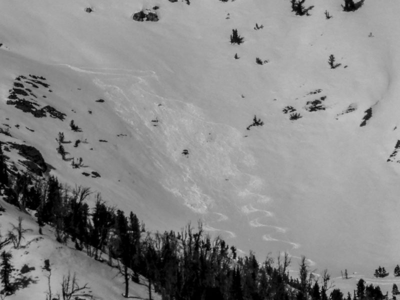
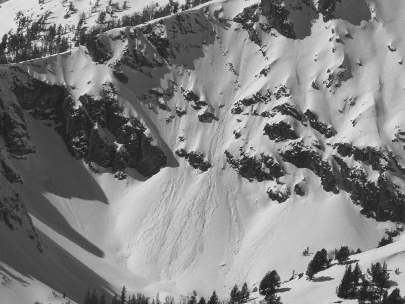
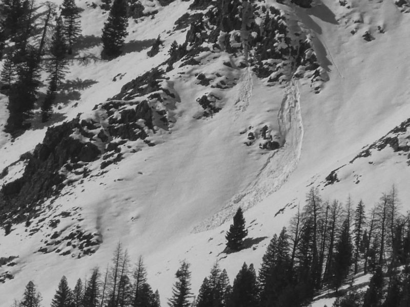
I observed some small (D1) wet loose in the Smokys and Boulders (as of 330 PM). There were only a handful to be counted after looking through several pictures.
Snowpack Observations
All aspects up to 9,000' had some sort of crust below the recent snowfall (razor-thin on steep true norths).
Low elevations were weak and heavily faceted. They had seen a good amount of moisture pumped through them from previous warm-ups (depending on aspect). There were percolation channels in steep, shaded, N-facing terrain. Recent snow still was just getting moist on shaded N-facing crusts in the afternoon.
Middle elevation HS ranges from 70-100 cm. Below the recent snow and crusts, the snowpack is generally heavily faceted to the ground. Norths still ski decently well with only a razor crust under the recent storm snow. Crusts increased in thickness around to due south. Both west and east aspects had a 5 cm crust with facet chains under it. Below the facet chains was a 20 cm layer of F- facets. Steep souths were soft but still supportable to skis during the heat of the day and the 40 cm MFcr at the surface still had a little crunch to it.
Avalanche Problems
| Problem | Location | Distribution | Sensitivity | Size | Comments |
|---|---|---|---|---|---|
 Wet Loose
|
|
Layer Depth/Date: 40 cm |
Terrain Use
I would have been cautious around steep, sheltered, SW-WNW facing slopes in the late afternoon for wet loose concerns.