Pro Field Report
Basic Information
Observation Details
Observation Date:
April 5, 2020Submitted:
April 6, 2020Observer:
SAC - VandenBosZone or Region:
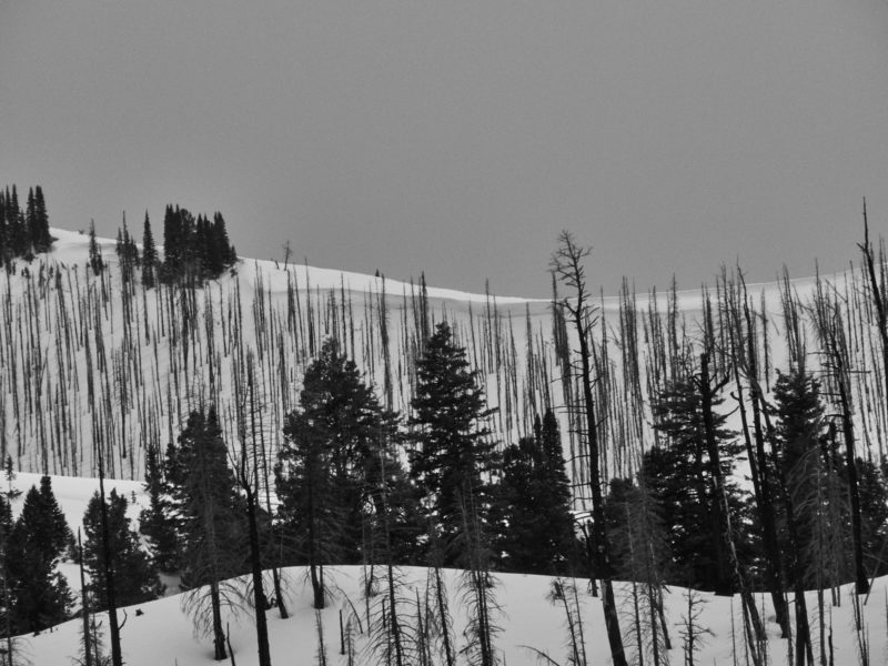
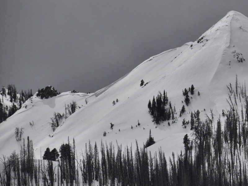
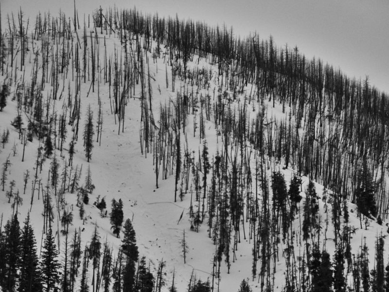
Soldier and Wood River Valley MtnsLocation:
DollarhideSigns of Unstable Snow
Recent Avalanches?
YesCracking?
None ExperiencedCollapsing?
None ExperiencedSnow Stability
Stability Rating:
FairConfidence in Rating:
Stability Trend:
Bottom Line
As expected, snowpack much thicker near Dollarhide than in eastern portion of this zone. Weak layer of concern is 4-5cm thick layer of 2-2.5mm facets, which was variably reactive in stability tests.
Media/Attachments
Advanced Information
Weather Summary
Afternoon weather obs: Mostly cloudy skies increasing to overcast and then obscured. Precipitation picked up around 1645, with a bout of S2-S3 snowfall lasting until exit from the field at 1800. Rain/snow line was hovering around 5,800-6,000'.
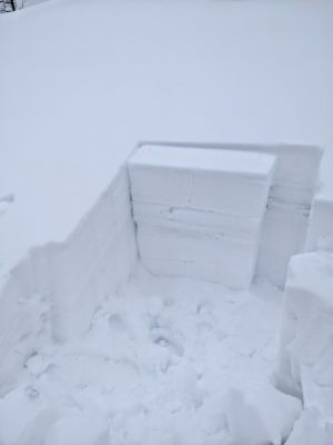
Snowpack Observations
Upper snowpack was surprisingly wet, it felt like it had been rained on a bit or undergone some intense ambient melting. Liquid water had penetrated about 30-40cm down into the snowpack, slowed by several crusts. New/old interface was very wet, borderline slush, down 25cm. Lower down, this interface was closer to 15cm down, thanks to amount of melt. Weak layer of concern was down 45 cm, a layer of 2-2.5mm FC below a 2cm MFcr. These FC were ever so slightly moist where I dug, at 8,000' on a NE-facing slope, and produced variably snowpack test results. ECTs produced ECTNs in the upper single digits to low teens on both the new/old interface and the facets down 45cm. CPST produced consistent failures to end in the upper 20s/100 to low 30s/100.
Avalanche Problems
| Problem | Location | Distribution | Sensitivity | Size | Comments |
|---|---|---|---|---|---|
 Persistent Slab
|
|
Layer Depth/Date: Down 45cm Comments: Location rose filled in for where problem was observed |
Terrain Use
Avoided traveling in avalanche terrain due to uncertainty around persistent slab problem.