Pro Field Report
Basic Information
Observation Details
Observation Date:
December 22, 2020Submitted:
December 23, 2020Observer:
SAC - Chris Lundy (off duty)Zone or Region:
Banner SummitLocation:
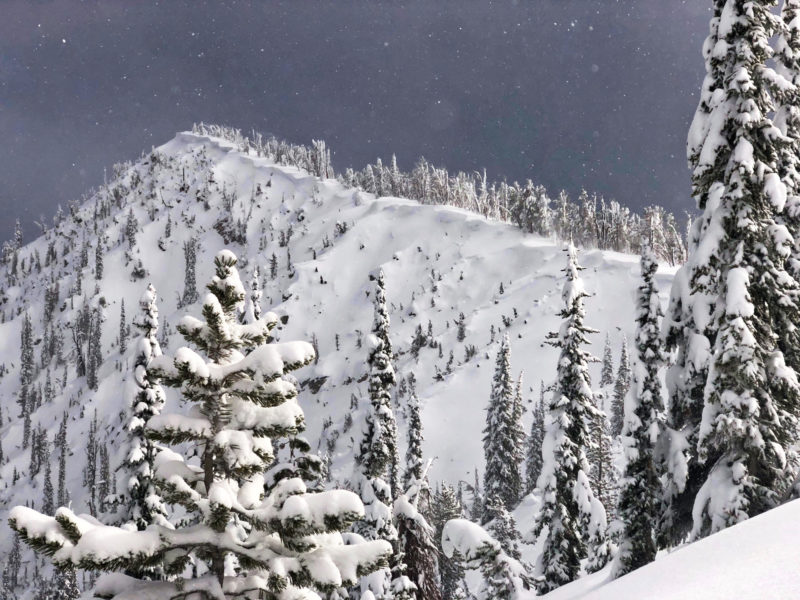
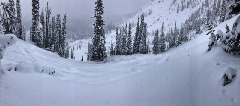
South of Copper (6900-8800', most aspects)Signs of Unstable Snow
Recent Avalanches?
YesCracking?
None ExperiencedCollapsing?
IsolatedSnow Stability
Stability Rating:
PoorConfidence in Rating:
ModerateStability Trend:
SteadyBottom Line
Avalanche conditions are dangerous. If there wasn't much of a slab before, there is now. A 16-24", relatively dense slab sits atop the very weak facet layer. Stability test scores remain poor, and the moderate to strong NW winds were continuing to load upper elevation slopes. Only felt two medium collapses.
Advanced Information
Weather Summary
Cloud Cover:
ObscuredTemperature:
teens FWind:
Moderate , NWS-1 most of the day. 7-10cm of low density new snow by mid-afternoon. NW winds at ridge level were M gusting to S and transporting snow.
Avalanche Observations
| # | Date | Location | Size | Type | Bed Sfc | Depth | Trigger | Photos | Details |
|---|---|---|---|---|---|---|---|---|---|
| 10 |
Dec 21, 2020 (+/- 1 day) |
Two bowls south of Copper Mtn, draining into Swamp Creek NE 8800ft |
D2 | SS-Soft Slab | O-Old Snow | 1.5ft | N-Natural |
|
Report |
| 10 |
Dec 21, 2020 (+/- 1 day) |
Bowl south of Copper Mtn NE 8700ft |
D2 | SS-Soft Slab | O-Old Snow | 1.5ft | N-Natural |
|
Report |
| 1 |
Dec 21, 2020 (+/- 1 day) |
Base of Copper Mtn N 7100ft |
D1.5 | SS-Soft Slab | O-Old Snow | 0.5ft | N-Natural |
|
Report |
| 1 |
Dec 21, 2020 (+/- 1 day) |
Base of Copper along HWY 21 NW 6979ft |
D1.5 | SS-Soft Slab | N-Natural |
|
Report |
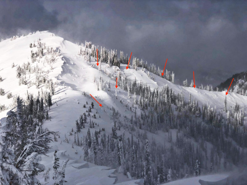
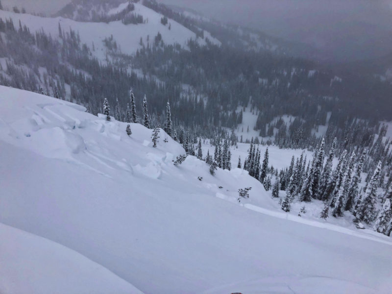
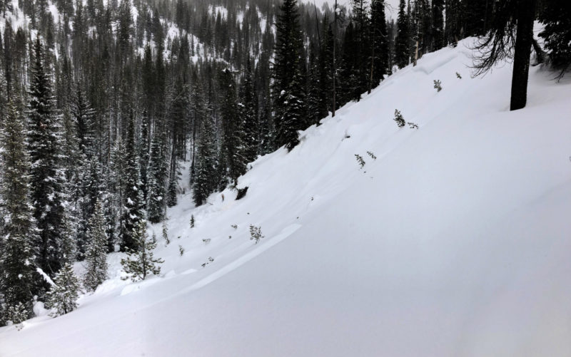
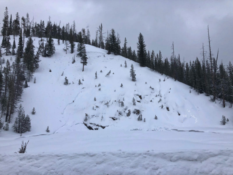
Widespread and extensive cycle of avalanches failing on the 12/11 facets breaking 40-60cm deep. Occurred at a variety of elevations. Pattern seemed to be primarily on shadier aspects, I did not see any on steep, low and mid elevation solars that were plenty steep. It's notable that a number of D2's ran in terrain that had weak basal snow, and none were observed to have stepped down. See avalanche observations for more details.
Snowpack Observations
Where to begin? It's a whole new world out there.
Crusts from rain exist to the mountain tops here (8900'). Thickness ranged from 4-5cm at the valley bottom to a soft 1-2cm up high. These are topped with 7-10cm of light snow. Crusts at low elevations are probably stout enough to increase snowpack stability. I didn't see where rain percolated deeper than 10cm or so.
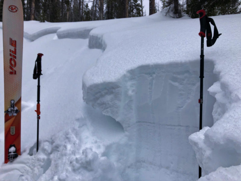
Slab depth on 12/11 facet layer ranged from 40cm off the valley floor to 60cm at upper elevations. Slab hardness is generally 4F nearly throughout. Facet layer hardness was F (which is better than it was before loading: F-), and dry everywhere I looked.
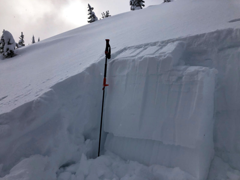
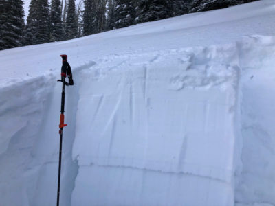
@8000', WNW: HS 115cm. Slab 50cm thick, ECTP13 x2. Got medium collapse on this slope. See first photo below.
@8800', E: HS 140cm. Slab 60cm thick. ECTP14. This pit was 100' above the crown of a D2 avalanche.

Avalanche Problems
| Problem | Location | Distribution | Sensitivity | Size | Comments |
|---|---|---|---|---|---|
 Persistent Slab
|
|
Layer Depth/Date: 40-60cm Weak Layer(s): Dec 11, 2020 (FCsf) Comments: Poor layering also exists at low elevations, but stout surface crusts are making it less reactive. |
Wind was actively transporting snow, but I did not observe much in the way of sensitive wind slabs.
Terrain Use
I avoided avalanche terrain. Ski conditions were weird at best and dangerous at worst.