Pro Field Report
Basic Information
Observation Details
Observation Date:
December 25, 2020Submitted:
December 25, 2020Observer:
SAC - Chris LundyZone or Region:
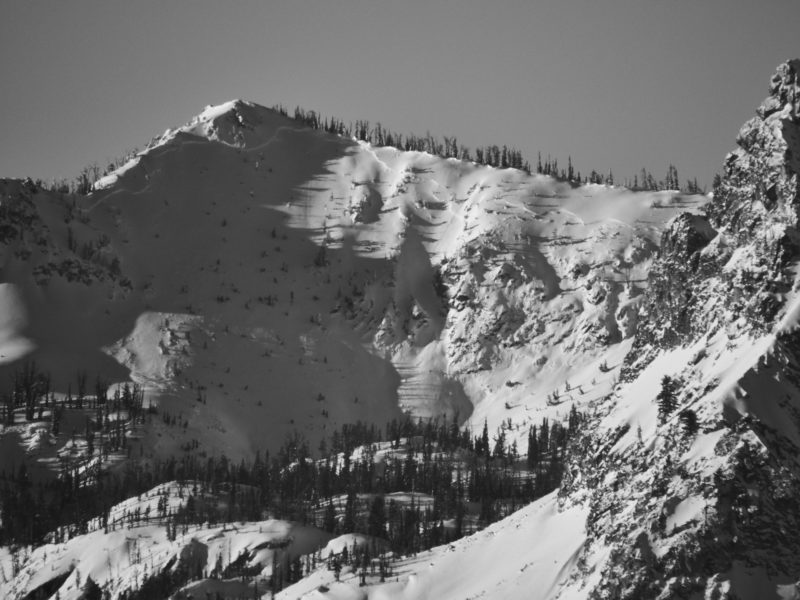
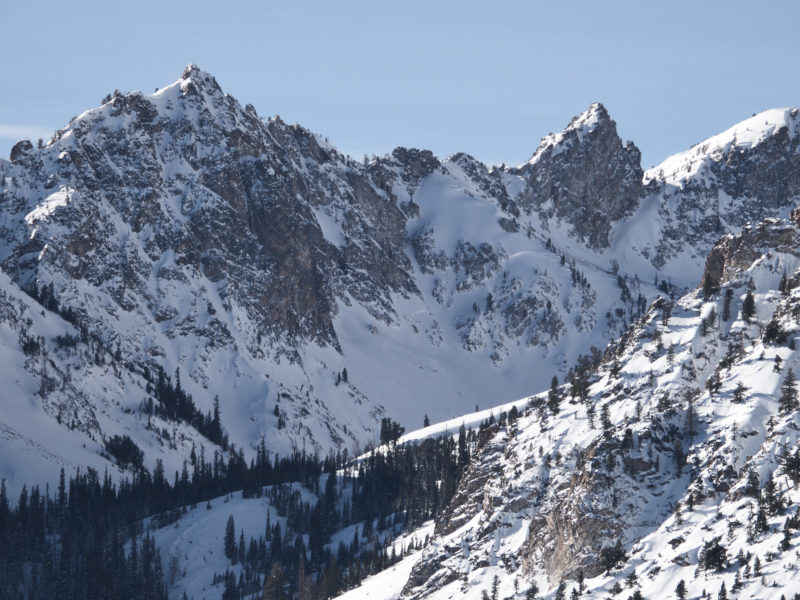
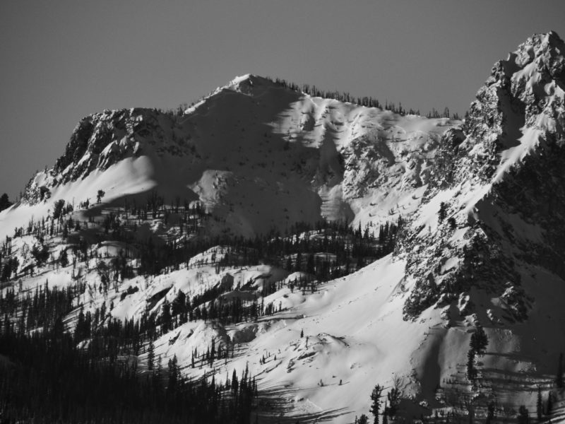
Sawtooth and Western Smoky MtnsLocation:
Williams Peak Area (6400-9400', SE-E-NE)Signs of Unstable Snow
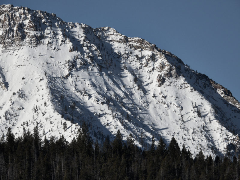
Recent Avalanches?
None ObservedCracking?
None ExperiencedCollapsing?
None ExperiencedSnow Stability
Stability Rating:
FairConfidence in Rating:
ModerateStability Trend:
SteadyBottom Line
Very weak facet layer remains widespread and buried around 16" deep. Although stability has improved since earlier in the week, poor snowpack test scores and scary layering are reminders that we're not out of the woods yet. Stability will likely deteriorate tonight into tomorrow as more snow comes our way.
Advanced Information
Weather Summary
Cloud Cover:
Partly CloudyTemperature:
coolWind:
Moderate , SWSkies started out with few clouds this morning. High clouds increased through the day, and by later afternoon it was fully overcast. Ridgeline winds kicked in mid-afternoon and were moving small amounts of snow.
Avalanche Observations
| # | Date | Location | Size | Type | Bed Sfc | Depth | Trigger | Photos | Details |
|---|---|---|---|---|---|---|---|---|---|
| 30 |
Dec 21, 2020 (+/- 1 day) |
Northern Sawtooths E ft |
D2 | SS-Soft Slab | N-Natural |
|
Report | ||
| 1 |
Dec 21, 2020 (+/- 1 day) |
The "X" NE 9000ft |
D3 | SS-Soft Slab | N-Natural |
|
Report |
Snowpack Observations
Little to no slab present at low elevations - still a junky mix of crusts and facets.
Snow depths at middle elevations average 85-115cm. Widespread rain crust to at least 9400' topped with 5-8cm of light snow; crust becomes thinner with elevation. Some faceting apparent beneath crust, but snow above crust didn't look particularly faceted.
12/11 FC layer is widespread - it seems to have strengthened slightly, but not by much - it's still F to maybe F+. The slab above it averages around 40cm thick at mid-elevations and is 4F in hardness.
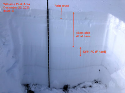
@8400, E, 28*: HS 115cm. 12/11 45cm down (see pit below). ECTN20s x2 - which was surprising given how poor the structure was. PST33/100end.
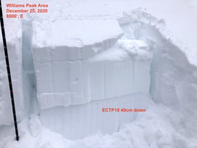
@8800, E, 30*: HS 115cm. 12/11 40cm down. ECTP18 (see below). Very poor structure.
Avalanche Problems
| Problem | Location | Distribution | Sensitivity | Size | Comments |
|---|---|---|---|---|---|
 Persistent Slab
|
|
Layer Depth/Date: 40cm Weak Layer(s): Dec 11, 2020 (FCsf) |
Terrain Use
I avoided consequential slopes steeper than 35 degrees.