Pro Field Report
Basic Information
Observation Details
Observation Date:
March 27, 2021Submitted:
March 27, 2021Observer:
SAC - Chris LundyZone or Region:
Banner SummitLocation:
Lola Creek (and glassing N Sawtooths) (6500-8800', N-E-S)Signs of Unstable Snow
Recent Avalanches?
YesCracking?
None ExperiencedCollapsing?
None ExperiencedSnow Stability
Stability Rating:
Very GoodConfidence in Rating:
HighStability Trend:
SteadyBottom Line
Conditions were as forecast - generally stable conditions with no significant avalanche problems. Wind slabs were isolated, small, and unreactive. A few small natural wet loose were observed, and you likely could have triggered a small wet sluff on a steep, sunny slope.
Media/Attachments
Advanced Information
Weather Summary
Cloud Cover:
Mostly SunnyTemperature:
warmWind:
Light , NWNew/Recent Snowfall:
Settled HST from 3/24 storm was about 10cmA few thin, high clouds - for all intents and purposes it was was clear. Temps were still warming when I left the field midafternoon.
Avalanche Observations
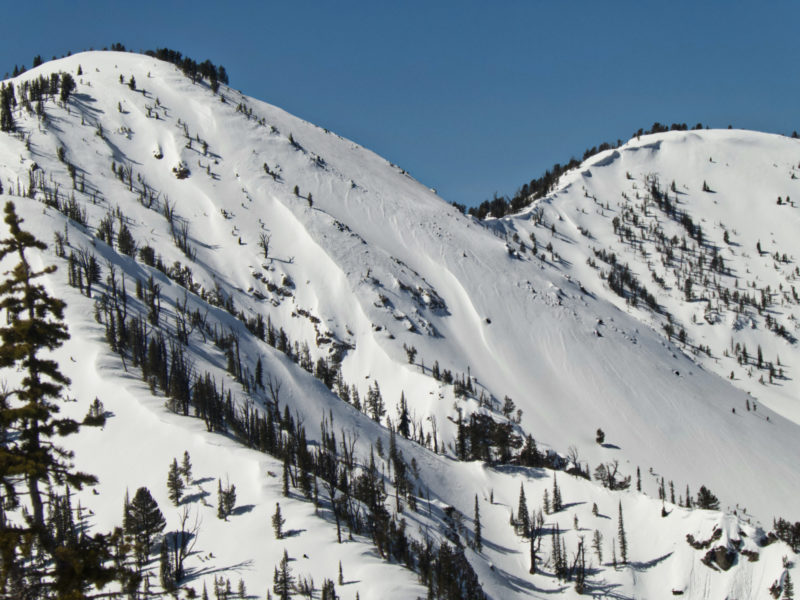
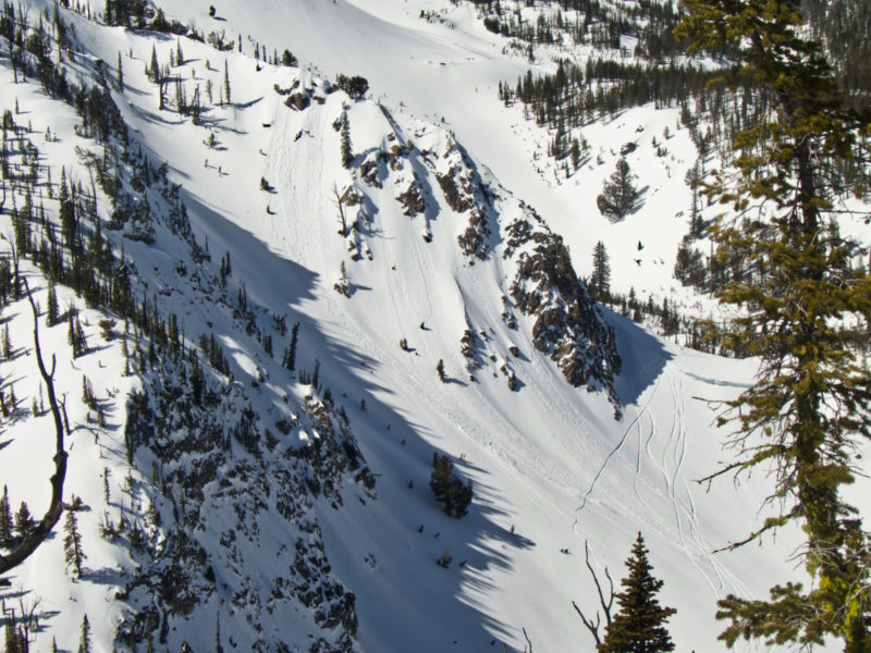
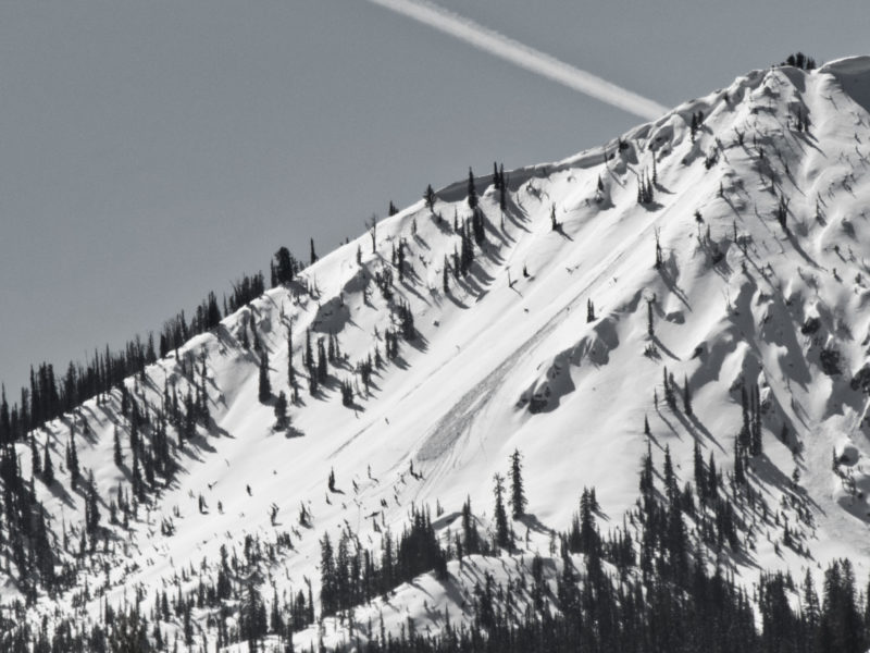
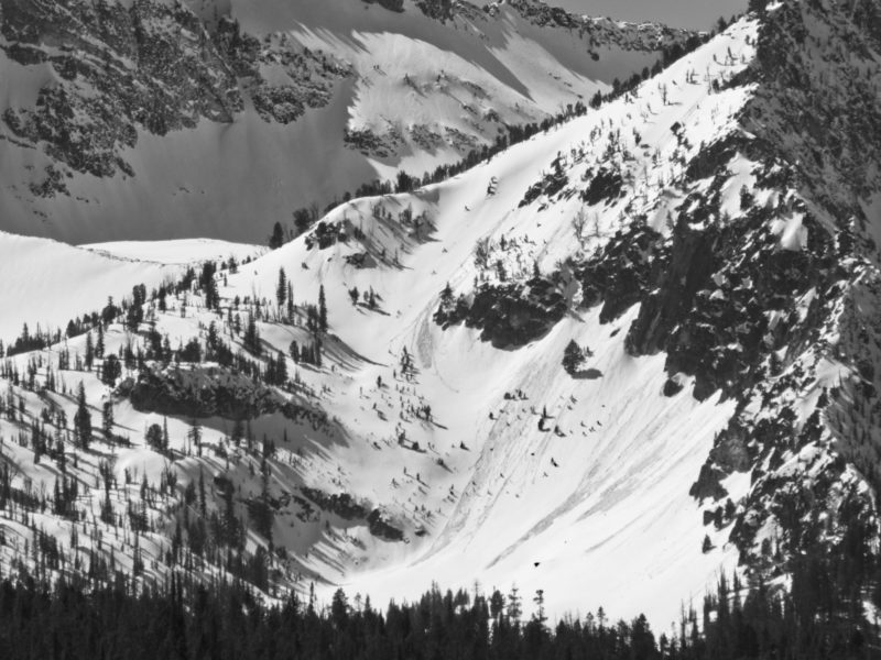
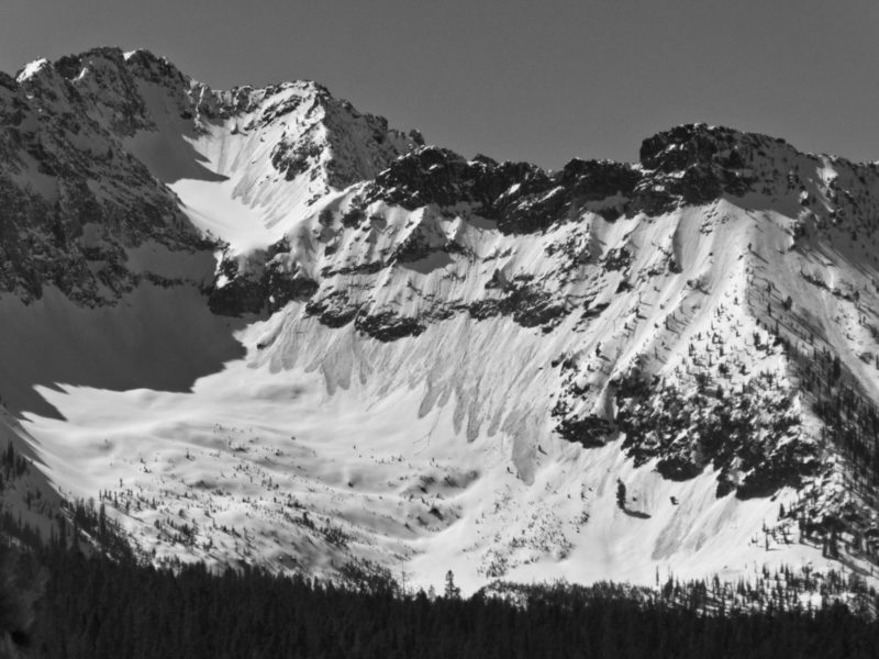
Saw a handful of D1 wet loose in the Banner Summit area, the largest is included in the photos. They were not particularly common in the terrain I viewed. I left the area around 1430, so more could have happened later this afternoon.
I also glassed from the Stanley Ranger Station and observed numerous wet loose slides. All were D1 and in fairly typical locations (see photos). I'm unsure if the majority of these ran today or yesterday - probably a mix.
Snowpack Observations
As mentioned above, the HST from 3/24 was about 10cm. There was a subtle/thin crust below this on solars, with a total of 25-30cm sitting on the 3/18 crust.
Low elevation sunny slopes had 10-20cm of moist surface snow at 1400, but were strong below the surface melt, supportable, and skied like soft/slow corn. Mid to upper elevation solars likely had deeper mush and were probably more problematic from a wet loose perspective.
Avalanche Problems
| Problem | Location | Distribution | Sensitivity | Size | Comments |
|---|---|---|---|---|---|
 Wet Loose
|
|
I did not observe a wind slab problem. The wind slabs I saw were generally on solar aspects (from the N wind) and were small, warm/"gooey", and unreactive. There was some evidence of N winds in shaded terrain (upslope and cross-slope) but this did not produce any mid-slope wind loading that I saw. Dry loose was not a concern on 40+ shady terrain.
Terrain Use
I felt comfortable in about any terrain that was shaded/cold. I watched for evidence of wind slabs but did not see any. I would have avoided steep, sunny slope by afternoon.