Pro Field Report
Basic Information
Observation Details
Observation Date:
October 26, 2021Submitted:
October 27, 2021Observer:
SAC - Chris, Scott, EthanZone or Region:
Galena Summit and Eastern MtnsLocation:
Titus Ridge (8700-10000', most aspects)Signs of Unstable Snow
Recent Avalanches?
YesCracking?
None ExperiencedCollapsing?
IsolatedSnow Stability
Stability Rating:
GoodConfidence in Rating:
ModerateStability Trend:
SteadyBottom Line
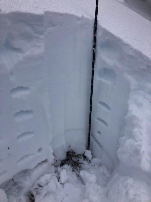
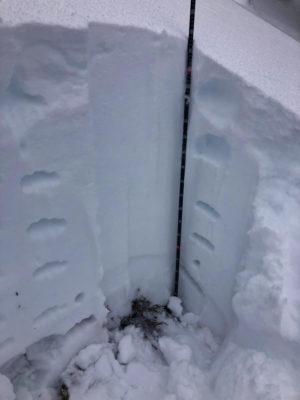
2-3' of snow is on the ground above around 8500'. The recent storm cycle dropped 2+' of new snow. The very warm start to the storm (high elevation rain?) moistened the old early October snow (where it existed) and produced a dense, supportable base. Still have little snowpack information and would be concerned where the old October snow stayed dry and weak - possibly above 10k' or in portions of the forecast area that were colder at the start of the storm. Travel conditions were better than expected.
Media/Attachments
Advanced Information
Weather Summary
Cloud Cover:
OvercastWind:
Light , NWNew/Recent Snowfall:
HST from 10/22 storm around 50-65cm depending on elevation.Avalanche Observations
| # | Date | Location | Size | Type | Bed Sfc | Depth | Trigger | Comments | Photo |
|---|---|---|---|---|---|---|---|---|---|
| Several |
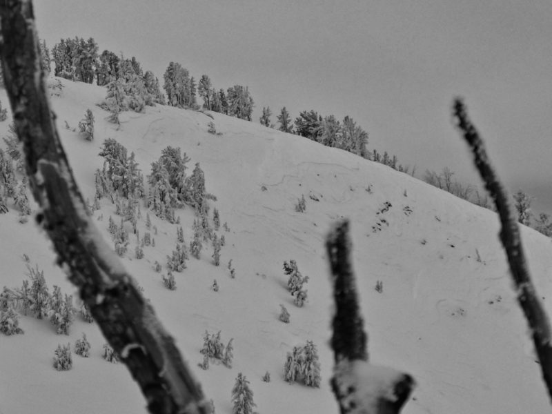
Weather Station Peak NW 10000 |
D1.5 | SS | S-New Snow | N-Natural | Thin avalanches breaking within the recent storm snow. |

|
||
| Several |
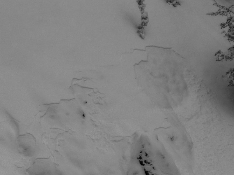
Titus Ridge SE 9400 |
D1 | SS | S-New Snow | N-Natural | Thin avalanches breaking within the recent storm snow. |

|
||
| Several |
Boulder and Goat Peaks Upper |
D1.5 | SS | S-New Snow | N-Natural | Thin avalanches breaking within the recent storm snow. | None |
Observed avalanches seem to be of similar depth, indicating they may have all released on the same mid-storm weakness.
Snowpack Observations
Total depth ranged from 50cm at the highway to 80-90cm at upper elevations. Snowpack was surprisingly supportable - ski pen 30-40cm. The 10/22 storm must have started out very warm, if not rain, as the base of the storm snow and the early October snow were both moist. We saw this in multiple snowpits up to 10k' (as high as we went). As a result, we did not observe the expected instability of the storm snow over weak early Oct snow and we received ECTXs.
Avalanche Problems
No avalanche problems observed.
Terrain Use
We skied up and back Titus Ridge. We avoided avalanche terrain since our AM trip plan was based on expected instability, lack of data, and shallow snow hazard.