Pro Field Report
Basic Information
Observation Details
Observation Date:
December 1, 2021Submitted:
December 2, 2021Observer:
SAC - VandenBosZone or Region:
Galena Summit and Eastern MtnsLocation:
Titus Ridge (8,700-9,500)Signs of Unstable Snow
Recent Avalanches?
None ObservedCracking?
None ExperiencedCollapsing?
None ExperiencedSnow Stability
Stability Rating:
Very GoodConfidence in Rating:
ModerateStability Trend:
SteadyBottom Line
The extended drought is having a detrimental impact on the snowpack, particularly on sopes at upper elevations and those that don't face the sun.
Media/Attachments
Advanced Information
Weather Summary
Cloud Cover:
Mostly SunnyTemperature:
way too warm (est 50 F at pass)Wind:
CalmSnowpack Observations
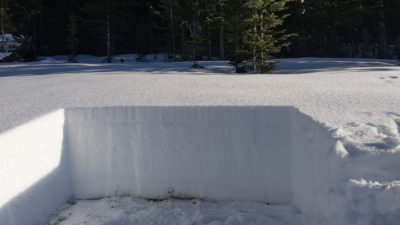
My primary objective was to look at how snow is behaving on colder slopes. I found that by around 9,000' on slopes that face the northern 1/4 of the compass the snowpack was mostly dry. There is some residual moisture at the base of the snowpack (lower 10-15cm are still moist), but the majority of the snowpack is dry here (HS=60-70cm). Where the snowpack is mostly cold and dry it is slowly losing strength, particularly adjacent to the several crusts that exist in the upper half of the pack. Near these crusts, I found some moderately faceted snow grains, but it was tough to get a good look at anything thanks to the ~50 F ambient air temperatures. I also found a variably distributed layer of surface hoar on the snow surface, with crystals up to 1cm in length. This was burned off in areas that receive much sun but was present on top of a subtle, ambient air temperature melt-freeze crust on colder slopes.