Pro Field Report
Basic Information
Observation Details
Observation Date:
December 15, 2021Submitted:
December 16, 2021Observer:
SAC - VandenBos, DavisZone or Region:
Galena Summit and Eastern MtnsLocation:
Galena Peak (7,3000-9,900, primarily SW-W-NW-N)Signs of Unstable Snow
Recent Avalanches?
YesCracking?
IsolatedCollapsing?
WidespreadSnow Stability
Stability Rating:
PoorConfidence in Rating:
LowStability Trend:
SteadyBottom Line
We found sensitive conditions that, based on the character of the weak layer, are likely to exist for sometime.
Media/Attachments
Advanced Information
Weather Summary
Cloud Cover:
OvercastTemperature:
coldWind:
Light , NWNew/Recent Snowfall:
60cm settled HSTHigh stratus streaming through by sunrise, overcast by 1000, low clouds bring S-1 precip across the Smoky crest and the headwaters of the Salmon by 1200. Calm winds becoming light out of NW in the early afternoon.
Avalanche Observations
| # | Date | Location | Size | Type | Bed Sfc | Depth | Trigger | Photos | Details |
|---|---|---|---|---|---|---|---|---|---|
| 3 |
Dec 14, 2021 (+/- 1 day) |
Saviers Peak NE 10000ft |
D2 | SS-Soft Slab | N-Natural | Report | |||
| 1 |
Dec 14, 2021 (+/- 1 day) |
Prairie Creek NE 9600ft |
D2.5 | SS-Soft Slab | N-Natural |
|
Report | ||
| 2 |
Dec 14, 2021 (+/- 1 day) |
Cabin Creek N 9400ft |
D2 | SS-Soft Slab | N-Natural |
|
Report |
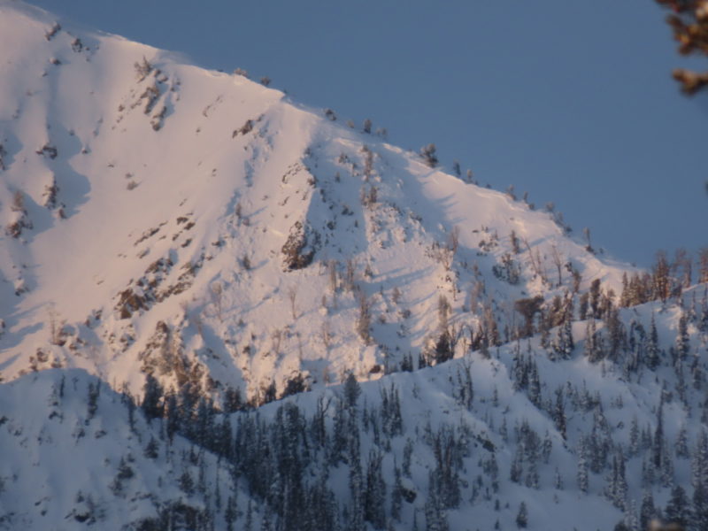
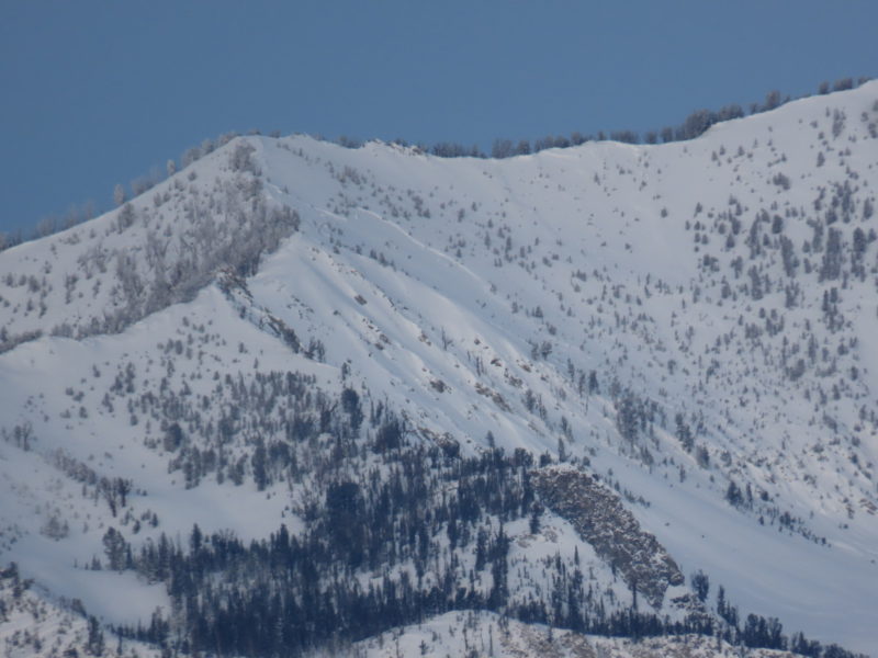
We saw a large number of D2 and D2.5 avalanches along the Smoky crest and in the mountains and hills to the east of the crest. Most of these slides failed in wind affected terrain and exhibited persistent slab characteristics, likely indicating that they failed on or near the 12/11 interface. We also observed some smaller slides in more sheltered terrain that appeared to have failed on this interface.
While I have seen many of these paths produce larger avalanches, this was about as widespread of a cycle as I've seen in the Smoky Mountains.
Snowpack Observations
Dug on SW at 8,500' where HS=85cm, looking to see how new/old interface is behaving on solar/solar margins. Received ECTP2 and 3 down 60cm at the base of the new snow on a thin layer of facets on top of the icy/melt-freeze polycrystal mess that was well adhered to the ground. As we climbed higher and onto more shaded aspects this layer of facets became thicker. Where the snowpack was not capped with a stiffer wind slab we received a number of generally localized collapses. Where stiffer slabs existed on the surface it was more difficult to impact the weak layer.
Avalanche Problems
| Problem | Location | Distribution | Sensitivity | Size | Comments |
|---|---|---|---|---|---|
 Persistent Slab
|
|
Layer Depth/Date: down 60cm Weak Layer(s): Dec 11, 2021 (FC) Comments: Rose is shaded both based on where problem was observed directly and where it was assumed to exist based on previous observations in similar snowpacks. The character of this interface varies by aspect but the layer is problematic everywhere I've looked at it. I'd imagine that upper elevation solars could make avalanches on this layer as well, but I don't have any data on this. On those aspects it likely manifests as a slick, icy crust with or without facets. Based on the pattern of observed activity this layer is much less reactive on solars. |
|||
 Wind Slab
|
|
Comments: Some thinner slabs extended down into middle elevations in places, but were much larger and likely more sensitive at higher elevations. We had no interest in poking into terrain where these would be a problem, the persistent slab problem is pretty terrain limiting. |
Terrain Use
We planned to avoid avalanche terrain and we stuck with this plan.