Pro Field Report
Basic Information
Observation Details
Observation Date:
December 28, 2021Submitted:
December 28, 2021Observer:
SAC - DavisZone or Region:
Soldier and Wood River Valley MtnsLocation:
Warm Springs Ck, Shaw (6,500-7,900, Primarily S-SE-E-NE)Signs of Unstable Snow
Recent Avalanches?
YesCracking?
None ExperiencedCollapsing?
None ExperiencedSnow Stability
Stability Rating:
GoodConfidence in Rating:
LowStability Trend:
ImprovingBottom Line
There was an overall lack of obvious, large slides from late in the storm. I did not find any concerning results at the recent storm interface (since 12/22) or within the storm snow. The weak snow at the ground on shaded middle aspects is still spooky, but is now >120 cm down and is harder to impact.
Media/Attachments


Advanced Information
Weather Summary
Cloud Cover:
Partly CloudyTemperature:
Single Digits FWind:
Moderate , NNew/Recent Snowfall:
HST = 60-70 cm since 12/22Periods of mostly clear skies. Passing mid and high clouds produced S-1 with no accumulation. N and NW wind was transporting snow along the Smoky Mountain crest near Shaw and at the head of Placer Ck.
Avalanche Observations
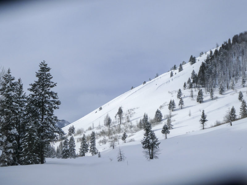
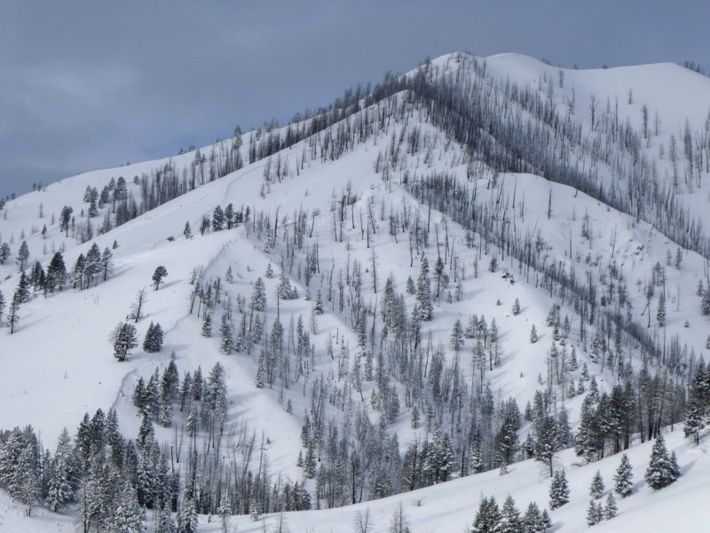
I had good visibility near the head of Placer Ck, as well as Shaw Pk. I also had good visibility of the mountains along Warm Springs Ck back to Ketchum. I only saw a few small (D1) loose snow avalanches.
Snowpack Observations
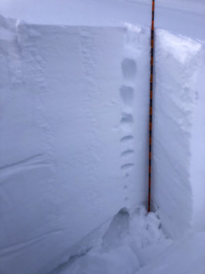
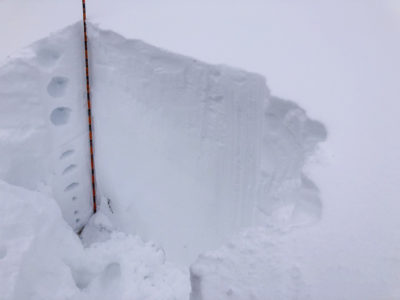
I toured middle elevations between 7,000' and 7,900'. On a SE aspect at 7,400' (HS = 130 cm) I didn't find old October snow. The snowpack was well graded from top to bottom (see image). There was 60-70 cm new snow since 12/22. The only noticeable layer was a 1 cm crust down 70 cm (12/19?). ---ECTN12 down 30 cm (x2), ECTN29 down 60 cm (x2).
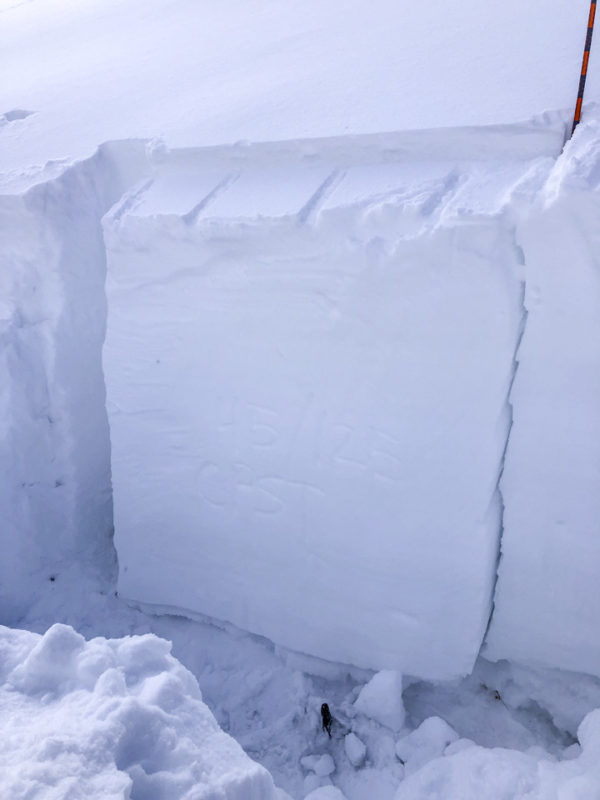
On a NNE aspect at 7,900' (HS = 155 cm), I again found a well-graded snowpack until the old October snow near the ground (see image). There was about 70 cm new snow above 12/22, and 125 cm above 12/11. There were dirty shears (ECTNs) in the upper 60 cm but nothing concerning. --- CPST 45/125 END on 12/11.
Avalanche Problems
| Problem | Location | Distribution | Sensitivity | Size | Comments |
|---|---|---|---|---|---|
 Persistent Slab
|
|
Layer Depth/Date: 125 cm Weak Layer(s): Dec 11, 2021 (FC) Comments: Shaded based on obs/ avalanche activity from surrounding area. Observed on 7,900' NNE. |
Wind was moving snow at upper elevations, likely building sensitive wind slabs. Previous wind has stiffened/drifted exposed middle elevation terrain in this area.
Terrain Use
I planned to avoid avalanche terrain where I suspected 12/11 to exist and stuck to that plan.