Pro Field Report
Basic Information
Observation Details
Observation Date:
January 4, 2022Submitted:
January 4, 2022Observer:
SAC - Davis, SavageZone or Region:
Galena Summit and Eastern MtnsLocation:
Horton Pk (NW-W-SW-S-SE, 7,300-8,800)Signs of Unstable Snow
Recent Avalanches?
None ObservedCracking?
None ExperiencedCollapsing?
None ExperiencedSnow Stability
Stability Rating:
GoodConfidence in Rating:
ModerateStability Trend:
SteadyBottom Line
There wasn't enough new snow or wind last night to change the picture at middle elevations in this area. Our primary avalanche concern was weak snow near the ground on more shaded aspects. The overall thinner snow cover here has helped to develop a weaker (more faceted) snowpack. Particularly on W-SW-S-SE facing slopes where the snowpack is generally <2' deep.
Media/Attachments
Advanced Information
Weather Summary
Cloud Cover:
OvercastTemperature:
15FWind:
Light , NWNew/Recent Snowfall:
HN = 10-15 cmOvercast, grey. No snow snowflakes while driving from Ketchum to Smiley Ck and back but it looked like there were some falling across the valley in the Smokys and Sawtooths. Not much wind while we were out, but the snow had been blown from trees on exposed middle elevation ridgelines.
Avalanche Observations
We had poor visibility and flat light. We did not see any obvious avalanches in the immediate vicinity of Horton Pk.
Snowpack Observations
HN 10-15 cm
Middle elevation W-S-SE: Snow depths ranged from 30-60 cm. The snowpack was generally thin, faceted, and weak. It was more faceted/weaker in the upper and lower snowpack, with slightly denser snow in the middle.
Weak crusts + small facets were found on steeper W-SW-S slopes at the (1/3) new/old interface.
No October snow on these aspects.
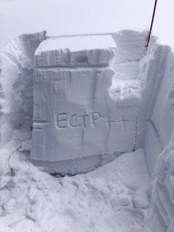
Middle elevation NW: Snow depths ranged from 85-105 cm. We found heavily rimed snow and small graupel at the base of the (1/3) storm snow, heavy graupel was reported at Smiley Ck Lodge. Well graded from F in the new snow to 4F-1F in the Christmas storm. The 12/11-12/19 snows were P and it all sat atop an ice mass capped with facets. See image.

Avalanche Problems
| Problem | Location | Distribution | Sensitivity | Size | Comments |
|---|---|---|---|---|---|
 Persistent Slab
|
|
Layer Depth/Date: 80 cm Weak Layer(s): Dec 11, 2021 (FC) Comments: Problem distribution based on weather and regional patterns. This layer is only 80 cm down and very much in play with any future big storm(s). |
We did encounter some spotty wind drifts up to ~1' thick but there really wasn't a wind slab problem at middle elevations where we traveled.
Terrain Use
We closed avalanche terrain where 12/11 was expected. In one thin, wind-swept location a fresh drift sat on a layer of well-developed facets. We opted to avoid this section and skied a more sheltered, lower-angled line.