Pro Field Report
Basic Information
Observation Details
Observation Date:
January 5, 2022Submitted:
January 5, 2022Observer:
SAC - DavisZone or Region:
Galena Summit and Eastern MtnsLocation:
Above Baker Lake (S-SE-E, 7,900-9,500)Signs of Unstable Snow
Recent Avalanches?
None ObservedCracking?
IsolatedCollapsing?
None ExperiencedSnow Stability
Stability Rating:
FairConfidence in Rating:
ModerateStability Trend:
SteadyBottom Line
There was plenty of new snow and wind to build wind slabs at upper elevation. In middle elevations, the swirling wind did not create wind slabs. There's over a foot of new snow here, but at this point, it does not pose any additional hazard in wind-sheltered terrain.
Media/Attachments
Advanced Information
Weather Summary
Cloud Cover:
OvercastTemperature:
Low 20sWind:
Moderate , WNew/Recent Snowfall:
HST = 30-40 cm since (1/3)It was 28 F at the Baker Ck lot and 30 F in Ketchum. I'd estimate it was in the low 20s F above Baker Lake. It snowed S1 for the majority of the afternoon. Wind blew moderate from the W at middle elevation and strong to extreme at upper elevations.
Avalanche Observations
There were no slab avalanches on the steeper slopes above Baker Ck road. I did not have the visibility to look into start zones.
Snowpack Observations
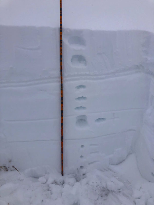
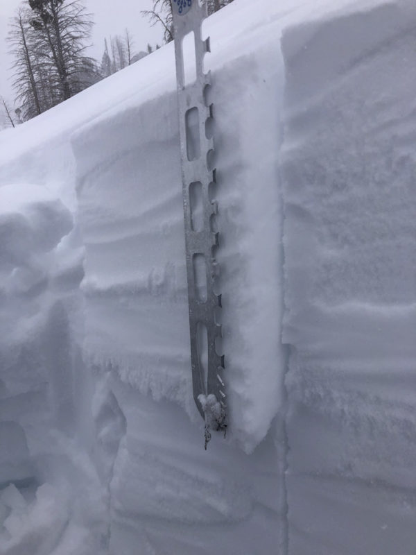
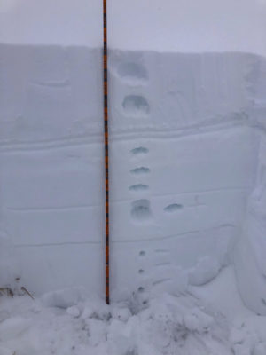
My objectives today were to look at the (1/3) and (12/19) interfaces on steeper solar aspects and to get a general update on the storm's progress. There is 1' or about 30 cm of new snow in the Baker Ck parking lot since Monday night.
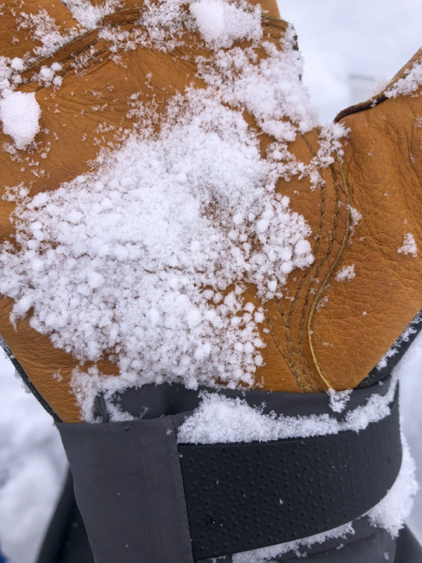
@8,600', SSW: HS 100-120cm. I found a fragile radiation recrystallization crust and obvious small facets at the (1/3) interface. I also found graupel at this interface in one of the two locations that I dug. The (12/19) layer consisted of small facets that were squished and decently bonded into the overlying slab. I recorded ECTNs (x2) throughout.
Avalanche Problems
| Problem | Location | Distribution | Sensitivity | Size | Comments |
|---|---|---|---|---|---|
 Wind Slab
|
|
Unknown |
Comments: I did not directly observe any wind slabs at the middle/upper transition. The wind here switched frequently from W to E, I felt like I was in a "back-eddy" from the obvious (loud) strong to extreme winds above me at the Smoky Crest. |
||
 Persistent Slab
|
|
Layer Depth/Date: >100 cm Weak Layer(s): Dec 11, 2021 (FC) Comments: Shaded based on regional patterns and previous obs. |
Terrain Use
Wind slabs in exposed middle and upper elevations, as well as old October snow on shaded middle and upper elevations, drove my terrain choices. I avoided avalanche terrain where these problems were thought/known to exist.