Pro Field Report
Basic Information
Observation Details
Observation Date:
January 6, 2022Submitted:
January 6, 2022Observer:
SAC - Scott SavageZone or Region:
Galena Summit and Eastern MtnsLocation:
driving Smiley Ck to Ketchum after a field day (roadside glassing and observations Smoky and Boulder Mtns from HWY75)Signs of Unstable Snow
Recent Avalanches?
YesCracking?
None ExperiencedCollapsing?
None ExperiencedBottom Line
I saw a couple of small to medium-sized avalanches: near Titus Ridge and in alpine terrain in the southern Boulder Mtns.
Dramatic differences in snowfall and wind from western Smoky Mtns to Ketchum:
Smiley Ck=2-3 feet of new snow past few days and little evidence of wind at middle+lower elevations
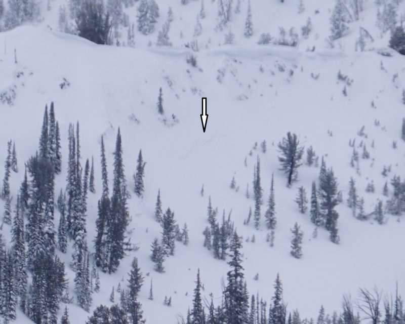
Galena Summit area=less but still a fair amount of storm snow with small sluffs in steep terrain, slab avalanche observed in Titus Ridge area (photo below), obvious middle elevation wind effects
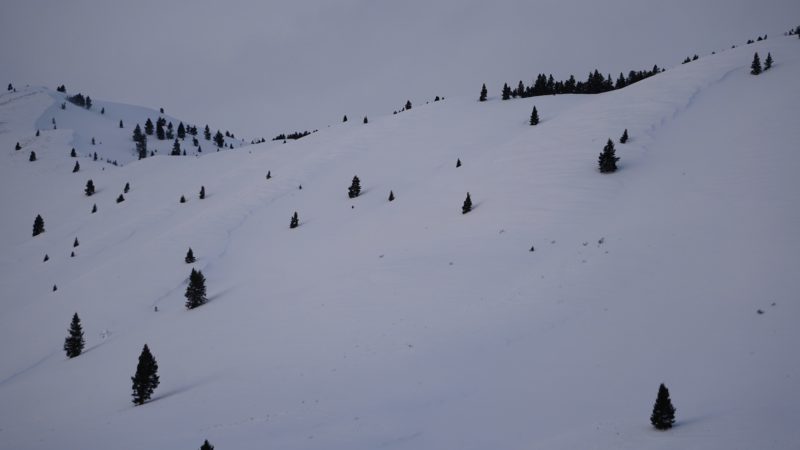
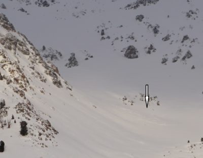
Owl Creek to Ketchum=decrease in new snow as you go south, pronounced middle and lower elevation cross-loaded slopes (see photo below), alpine terrain in Boulder Mtns was raked by high winds (one avalanche, photo below), some rollerballs from heat/muted sunshine on steep SW and W aspects along road in the Boulder Mtns from Owl Ck to Hulen Meadows
Media/Attachments
Advanced Information
Weather Summary
Cloud Cover:
Mostly CloudyTemperature:
Either side of 0C/32FWind:
LightNew/Recent Snowfall:
HST (storm snow) ranged from 6-12 inches near Ketchum to around 3 feet at 8000' in the Smiley Creek drainage..It was snowing S1-3 (~1 inch/hour) today in Smiley Creek...flurries/light snow showers and OVC on Galena Summit at 1600hrs...OVC around Galena Lodge...PC by Ketchum. Plenty of snow available for transport, especially as you go north and west in the Smoky Mtns.
Avalanche Observations
| # | Date | Location | Size | Type | Bed Sfc | Depth | Trigger | Photos | Details |
|---|---|---|---|---|---|---|---|---|---|
| 1 |
Jan 6, 2022 (+/- 1 day) |
Titus Ridge area N 9300ft |
D1.5 | SS-Soft Slab | 2ft | N-Natural |
|
Report |
| # | Date | Location | Size | Type | Bed Sfc | Depth | Trigger | Comments | Photo |
|---|---|---|---|---|---|---|---|---|---|
| 1 |
Boulder Mtns: near Silver and Boulder Peaks E alpine |
D1.5 | U | U-Unknown | I could only see the debris pile, unsure of timing and any details on this slide. |
|
Snowpack Observations
Only roadside observations - no direct snowpack data.
Avalanche Problems
No large persistent or deep persistent slides were observed, but visibility limited the terrain I could see. I had decent visibility and did not see significant natural activity in the Boulder Mtns south of Cerro Ciento, on the east face of Saviers Peak in Owl Creek, or in Smoky Mtns terrain visible from the HWY south of Owl Creek (W Fork Prairie, Prairie, Anderson, Norton, Newman Cks). Based on very limited observations, the natural activity appeared to be a mixture of wind slab and storm slab problems.
Terrain Use
N/A