Pro Field Report
Basic Information
Observation Details
Observation Date:
January 8, 2022Submitted:
January 8, 2022Observer:
SAC - Chris LundyZone or Region:
Sawtooth and Western Smoky MtnsLocation:
Glassing from Stanley to Galena OverlookSigns of Unstable Snow
Recent Avalanches?
YesCracking?
None ExperiencedCollapsing?
None ExperiencedBottom Line
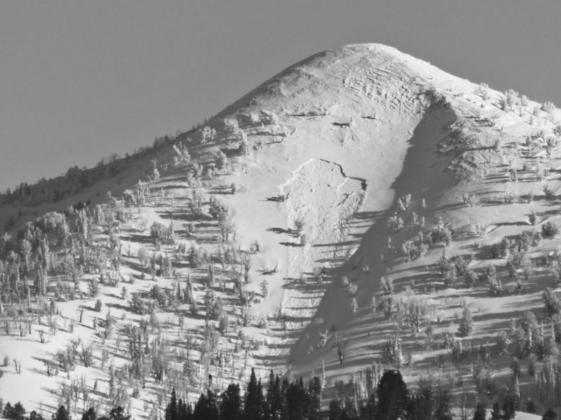
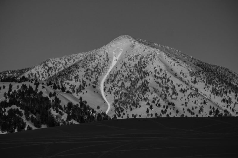
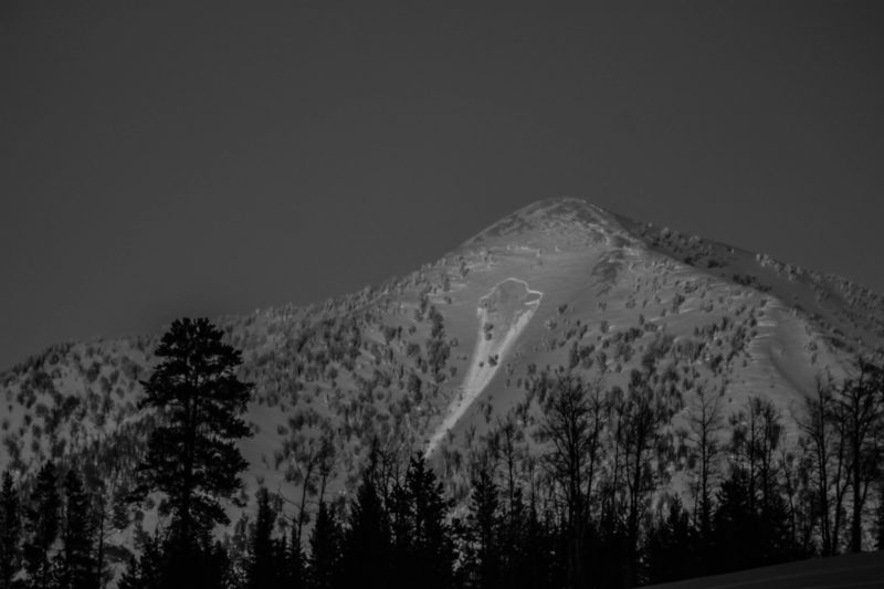
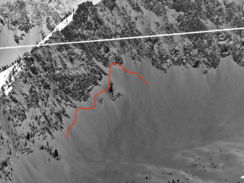
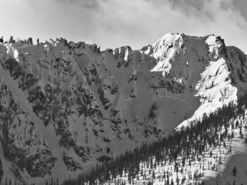
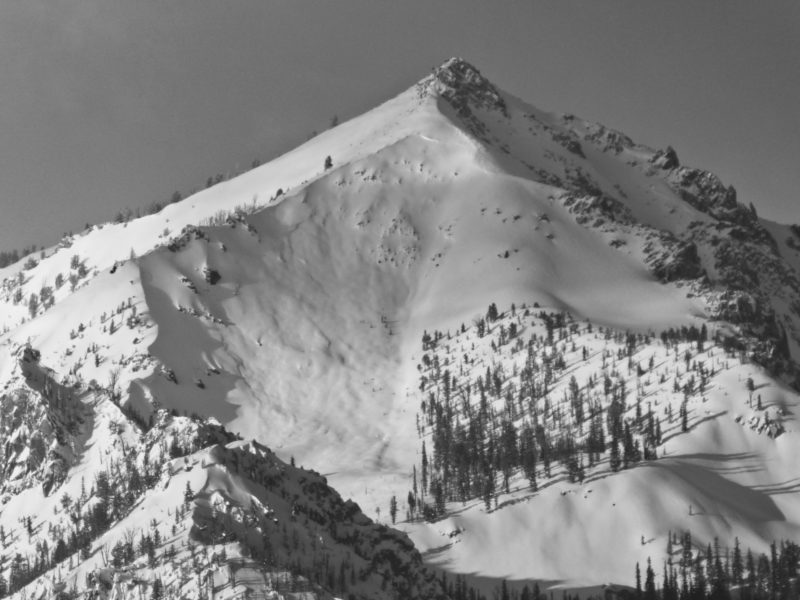
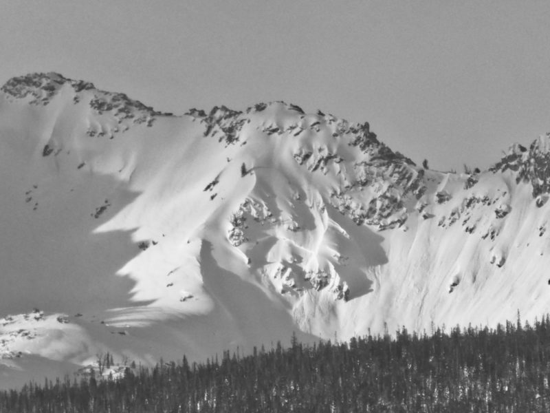
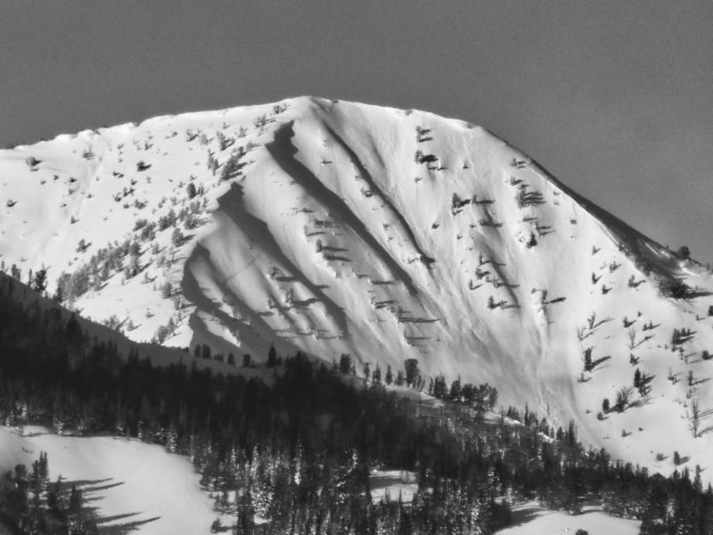
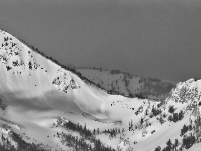
Glassed from Stanley to the Galena Overlook, so primarily viewing the Sawtooths and the drainages behind Smiley Creek. I was able to look up Pole Cr somewhat, but the Smoky Crest (Titus - Saviers) was obscured by a cloud.
I saw evidence of a storm-related avalanche cycle in the Sawtooths and the Western Smokys near Smiley Cr. I did not observe any deep persistent slab avalanches breaking on older weak layers.
Advanced Information
Weather Summary
Cloud Cover:
Partly CloudyIt was mostly cloudy this morning in Stanley, but the clouds dissipated mid-morning and skies were partly cloudy. Looking from Stanley, there appeared to be more clouds towards Banner Summit, even midday.
Avalanche Observations
| # | Date | Location | Size | Type | Bed Sfc | Depth | Trigger | Photos | Details |
|---|---|---|---|---|---|---|---|---|---|
| 1 |
Jan 7, 2022 (+/- 1 day) |
The "Spoon" above Twin/Pole Creeks SW 10000ft |
D2 | SS-Soft Slab | I-New/Old Interface | N-Natural |
|
Report | |
| 1 |
Jan 7, 2022 (+/- 1 day) |
Above Marshall Lake (Pokey Chute) E 8700ft |
D2 | SS-Soft Slab | N-Natural |
|
Report | ||
| 1 |
Jan 6, 2022 (+/- 3 days) |
Meadow Bowl N 9200ft |
D2 | N-Natural |
|
Report | |||
| 5 |
Jan 6, 2022 (+/- 3 days) |
McDonald Peak E 9700ft |
D2 | SS-Soft Slab | N-Natural |
|
Report | ||
| 1 |
Jan 6, 2022 (+/- 1 day) |
Goat/Iron Cr divide E 9300ft |
D2 | SS-Soft Slab | N-Natural |
|
Report | ||
| 1 |
Jan 6, 2022 (+/- 3 days) |
Imogene Peak E 9900ft |
D2.5 | N-Natural |
|
Report | |||
| 1 |
Jan 6, 2022 (+/- 1 day) |
North of Imogene Peak NE 9400ft |
D2 | SS-Soft Slab | N-Natural |
|
Report | ||
| 1 |
Jan 6, 2022 (+/- 3 days) |
Eureka Peak E 10000ft |
D2 | S-New Snow | N-Natural |
|
Report | ||
| 1 |
Jan 7, 2022 (+/- 1 day) |
Cabin Creek SE 9400ft |
D1.5 | S-New Snow | N-Natural |
|
Report |
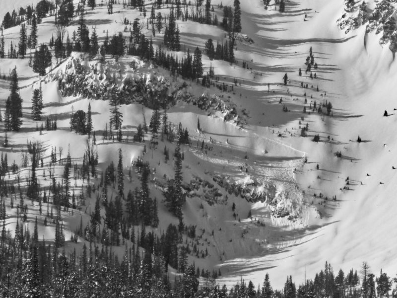
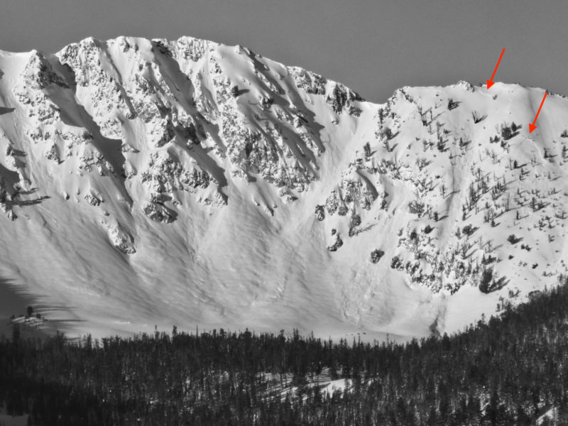
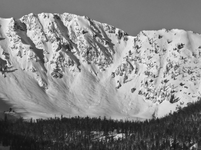
There was evidence of a storm-related avalanche cycle in the Sawtooths and the Western Smokys near Smiley Cr. I saw more avalanches in the Sawtooths, but that may be because I had a better view of them or possibly the steeper terrain was more conducive.
Most avalanches ran early or mid-storm, as evidenced by barely visible crowns and debris. There were a handful of fresher slides that ran towards the end of the storm. The details on most slides are obscured by storm snow, but none appeared to break very deep and they generally appeared to be failing within the storm snow or at the old/new (1/3) interface.
I did not observe any slides that broke on 12/11. There did not appear to be avalanches (with the possible exception of the Pole Cr slide) that broke on the 12/19-21 layers, although this is less certain.