Pro Field Report
Basic Information
Observation Details

Observation Date:
March 2, 2022Submitted:
March 2, 2022Observer:
SAC - VandenBos (off duty)Zone or Region:
Banner SummitLocation:
Bull Trout (6,900-8,900, most aspects)Signs of Unstable Snow
Recent Avalanches?
YesCracking?
None ExperiencedCollapsing?
IsolatedSnow Stability
Stability Rating:
FairConfidence in Rating:
LowStability Trend:
SteadyBottom Line
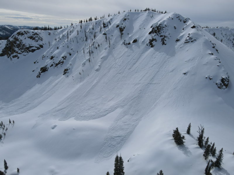
My goal was to have a look at the avalanches that I'd spotted the previous day. Based on these slides it appears that this zone has received enough recent snow to bring a persistent slab problem to the table.
Media/Attachments
Advanced Information
Weather Summary
Cloud Cover:
Mostly CloudyWind:
Moderate , SWVariably cloudy, more sun in the morning, becoming cloudier in the afternoon. Skies were overcast at exit from field at 1530 thanks to high stratus. Steady wind blowing moderate, gusting strong at upper elevations. Light out of the SW at middle, calm at lower. Very warm. No precip.
Avalanche Observations
| # | Date | Location | Size | Type | Bed Sfc | Depth | Trigger | Photos | Details |
|---|---|---|---|---|---|---|---|---|---|
| 5 |
Mar 1, 2022 (Exact) |
Bull Trout NE 8500ft |
D2 | SS-Soft Slab | 1.5ft | N-Natural |
|
Report |

There was a concentrated "mini-cycle" in the basin around Bull Trout point. I expected to see more a slab or two similar to the ones on Bull Trout in the terrain around Copper and to the south, but I did not see any. A few options for why: 1: weak layer was better developed around Bull Trout (this seems unlikely based on my previous obs). 2. This area has a great fetch for SW/W winds and this helped to slightly increase loading here (seems like the most likely reason, though lots of the copper terrain has a good fetch for SW/W wind as well). 3. the amount of ski and sled traffic around copper and south was enough to interrupt the weak layer somewhat (also seems reasonable). I'd guess some combo of 2 and 3. Either way, the big take home is that the weak snow buried in the upper snowpack has come close to/reached a tipping point here. Time will tell how it behaves as it receives additional loading.
Snowpack Observations
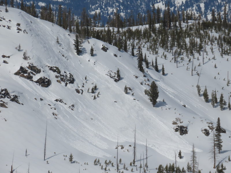
Primary goal for the day was to look at extent of avalanche activity in the Northern Sawtooths and Banner Summit areas and to investigate the slides I saw the evening before. There was a lot of small (D1 or smaller) wet activity here, most of it likely occurred during the rain-on-snow event on Tuesday. Many things that looked like slides from a distance were actually just swarms/seas/skeins of roller balls. It looked like most of these happened in areas where the precip from the storm started as snow and then switched over to rain. I did not see any wet loose D2s, but I'd imagine there were some out there. I was mostly looking for slab avalanches. I expected to see more a slab or two similar to the ones on Bull Trout in the terrain around Copper and to the south, but I did not see any.
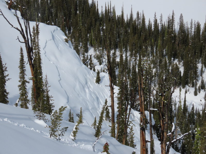
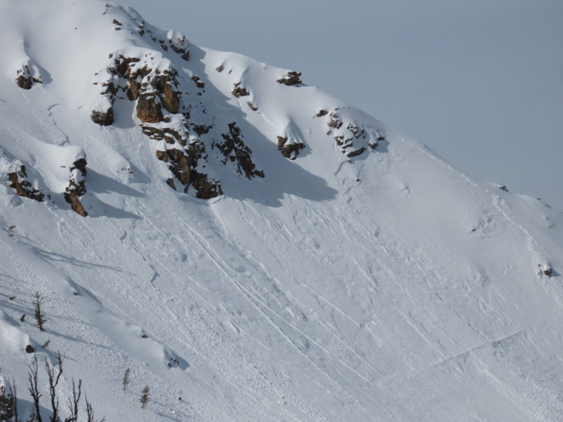
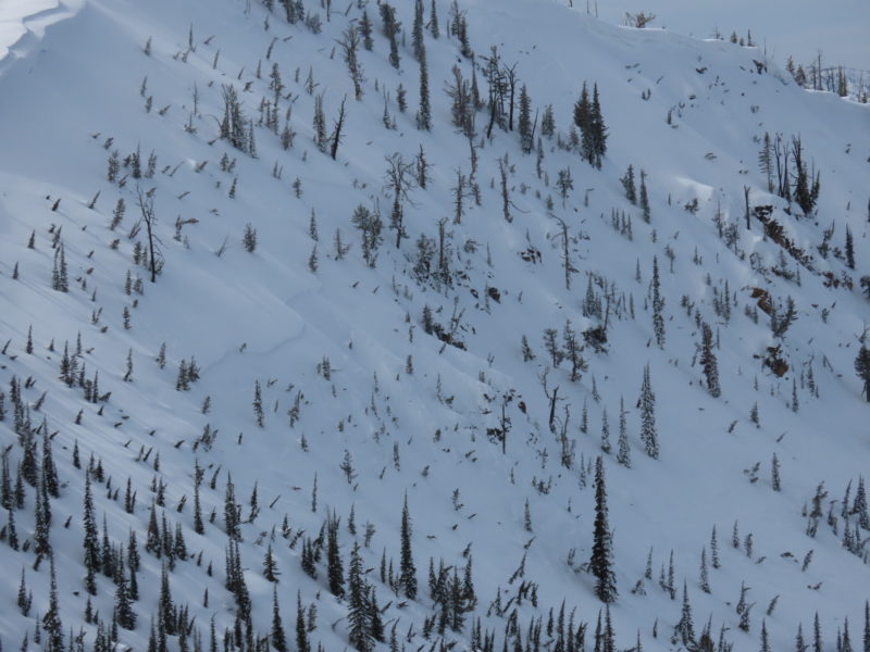
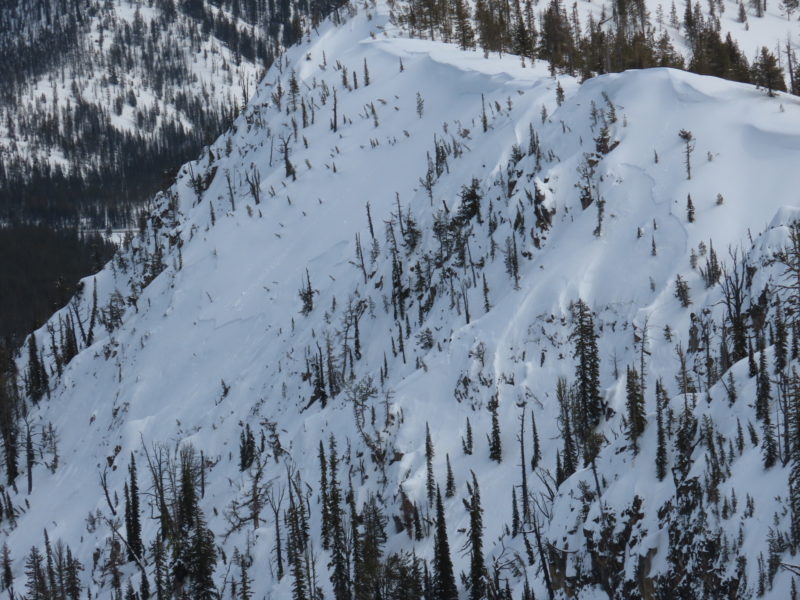
I toured over to the crowns on Bull Trout that I'd spotted the evening before but was not able to find a place where I could safely access them. Most were a ways below ridgelines and I wasn't comfortable descending to them. It is hard to say with certainty what exactly these failed on, but I think it is fairly safe to assume (based on crown width, significant cracking above the crowns and on nearby slopes that did not slide, the appearance of the bed surface, etc.) that they involved the couple of weak layers that we have buried in the upper snowpack (1/20, 1/31, 2/14, 2/20, 2/27). Based on their aspect, most of these would not have had a sun crust associated with them, but there was an ambient temp crust that formed up to about 8,500' on 2/9 (buried V-day). At this elevation I suspect it had largely faceted away.
There was a concentrated "mini-cycle" in the basin around Bull Trout point. I expected to see more a slab or two similar to the ones on Bull Trout in the terrain around Copper and to the south, but I did not see any. A few options for why: 1: weak layer was better developed around Bull Trout (this seems unlikely based on my previous obs). 2. This area has a great fetch for SW/W winds and this helped to slightly increase loading here (seems like the most likely reason, though lots of the copper terrain has a good fetch for SW/W wind as well). 3. the amount of ski and sled traffic around copper and south was enough to interrupt the weak layer somewhat (also seems reasonable). I'd guess some combo of 2 and 3. Either way, the big take home is that the weak snow buried in the upper snowpack has come close to/reached a tipping point here. Time will tell how it behaves as it receives additional loading.
Avalanche Problems
| Problem | Location | Distribution | Sensitivity | Size | Comments |
|---|---|---|---|---|---|
 Persistent Slab
|
|
Unknown |
Layer Depth/Date: 30-45cm Comments: Rose shaded based on where problem is likely at its worst. This weak snow does exist at lower elevations but rain and very warm temps may have helped to mute it a bit. It also exists in more sheltered upper elevation terrain, but has been cleaned back by strong winds in others. I have not had a good look at this layer on mid elevation solars. |
||
 Wet Loose
|
|
Comments: I was mostly just avoiding this problem today. Upper snowpack became saturated early in the day, there was liquid water on the surface by mid-morning. |