Basic Information
Observation Details
Observation Date:
March 2, 2022Submitted:
March 2, 2022Observer:
SAC - Lundy/Pro 2 motorized groupZone or Region:
Galena Summit and Eastern MtnsLocation:
Grand Prize (7200-9600', S-E-N)Signs of Unstable Snow
Recent Avalanches?
YesCracking?
IsolatedCollapsing?
None ExperiencedSnow Stability
Stability Rating:
GoodConfidence in Rating:
ModerateStability Trend:
ImprovingBottom Line
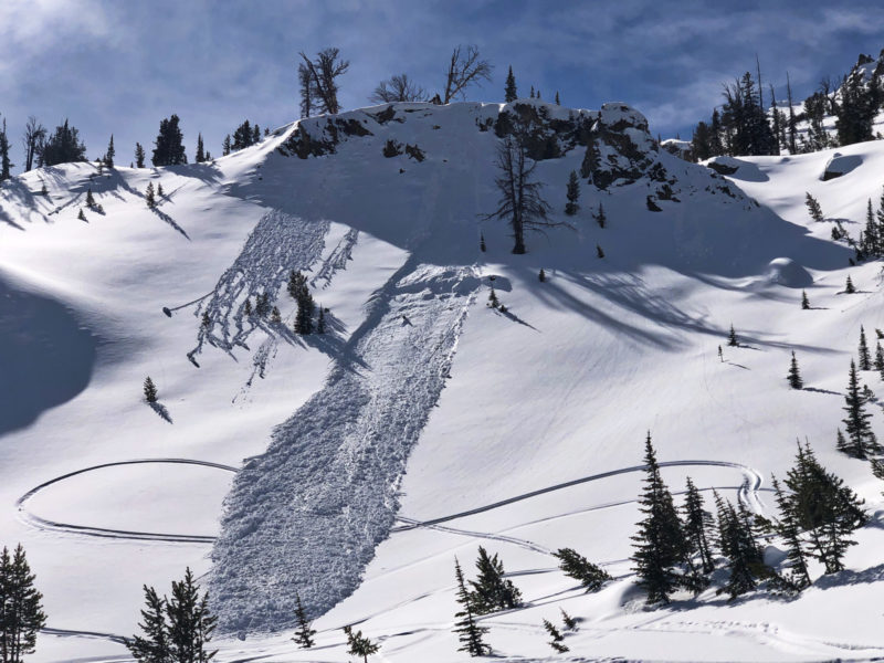
The 2/28-3/1 wet storm produced a cycle of wet loose avalanches. These were most common at middle elevations but occurred in all elevation bands. Wet snow continues to be problematic at lower elevations and on middle elevation sunny slopes. It appears that rain and/or wet snow fell in this area to around 9000'.
The recent storm did not create a significant change to the stability pattern at upper elevations - the main concern continues to be isolated new and older wind slabs.
Media/Attachments
Advanced Information
Weather Summary
Cloud Cover:
Partly CloudyTemperature:
warmWind:
LightNew/Recent Snowfall:
About 5-7cm above 9000' from the 2/28 storm
We did not get to ridge level, but observed what looked like moderate winds from the S along the Gladiator/Grand Prize divide. We had light and occasionally gusty winds in upper elevation open terrain.
Glassing the Sawtooths, there did not appear to be a significant amount of new snow from the 2/28 storm.
Avalanche Observations
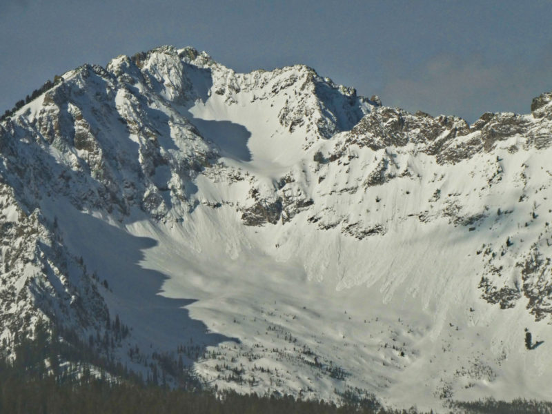
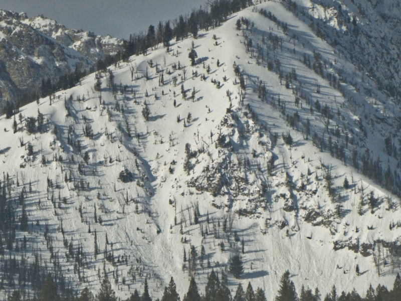
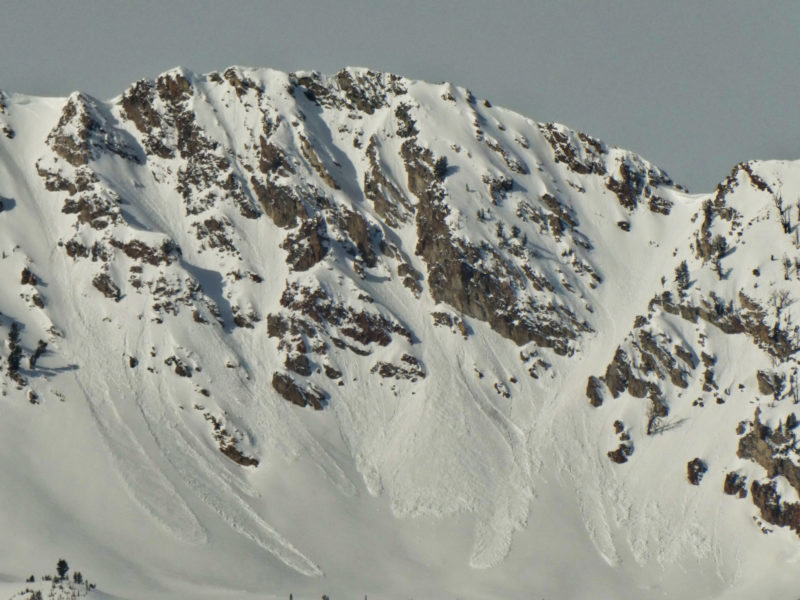
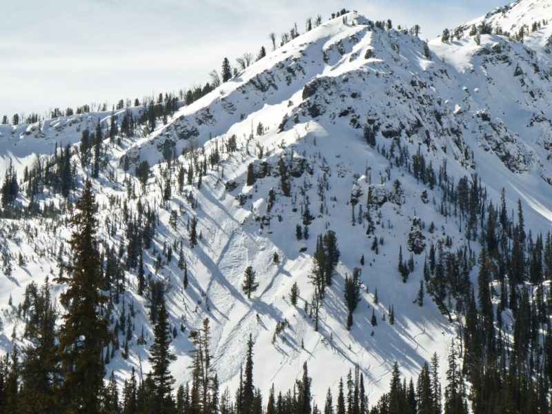
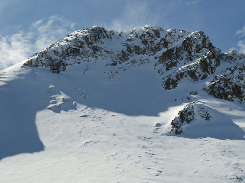
There was a widespread wet loose cycle from the 2/28-3/1 storm - see photos. Almost all were D1 with a few D1.5s. In the Sawtooths, most were surficial slides initiating from cliffs. A few pulled out small slabs that did not propagate very wide. In Pole Creek and Grand Prize, there were several that occurred on mid elevation (9000-9200') N aspects that looked like they initiated in moist surface snow, then entrained dry facets below and occasionally flanked out a few feet in the 10-15cm "baby slab" atop the facets. The bulk occurred at middle elevations, but a few occurred at upper elevations.
I only saw one slide that was a pure slab avalanche - a D1 thin wind slab near Cabin Cr peak in the Southern Sawtooths.
Snowpack Observations
Lower elevations: Wet, isothermal mush that received little to no freeze overnight. Boot pen was often full depth.
Middle elevations: On a shady slope at the low/middle transition, I found a thin surface crust (from the storm) with very weak, dry facets below. As you get up near 8500', there is a 10cm proto slab atop very weak interval facets. Shadys were moist at the surface to at least 9000'. There was a marked transition above 9000' to all dry snow and much better riding conditions. We did not travel on middle elevation solars, but I imagine they were a mushy mess.
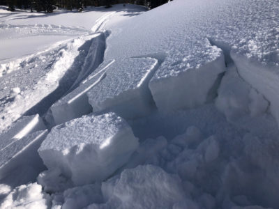
Upper elevations: We just barely got into upper elevations. Once into open, subalpine terrain there is widespread wind effect beneath 5-7cm of HST from the last storm. We dug on one small test slope (N, 9400') where there was 27cm slab containing a thin, old layer of wind-hardened snow and some more recent windblown snow sitting atop the interval FC. I got an ECTN, ECTP2 (x2) - see photo and video. Slope cuts above the pit produced some cracks up to 3m in length. I don't believe what we found in this pit was widespread, but a reminder that there are isolated wind slabs sitting atop FC.
At upper elevations, there wasn't that much new snow/wind to create a significant change to the pre-2/28 conditions. It felt like a soft MOD danger.

Avalanche Problems
| Problem | Location | Distribution | Sensitivity | Size | Comments |
|---|---|---|---|---|---|
 Wet Loose
|
|
Comments: Rose shading and sensitivity is a forecast based on observations today. |
|||
 Wind Slab
|
|
Comments: We found one test slope with previous and more recent wind effect in the subalpine that was touchy |


