Pro Field Report
Basic Information
Observation Details
Observation Date:
March 23, 2022Submitted:
March 23, 2022Observer:
SAC - Davis, VandenBosZone or Region:
Galena Summit and Eastern MtnsLocation:
Prairie Ck Pk (All but W, 7,000'-9,400')Signs of Unstable Snow
Recent Avalanches?
YesCracking?
None ExperiencedCollapsing?
None ExperiencedSnow Stability
Stability Rating:
FairConfidence in Rating:
HighStability Trend:
WorseningBottom Line
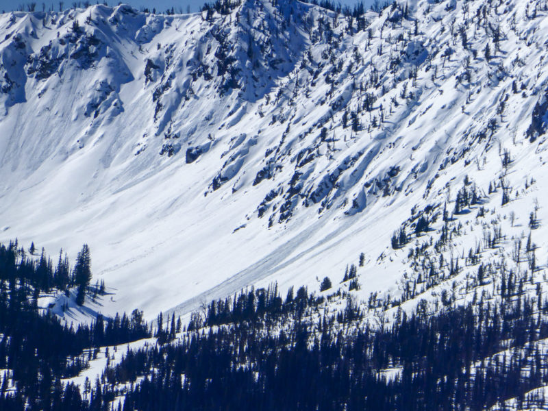
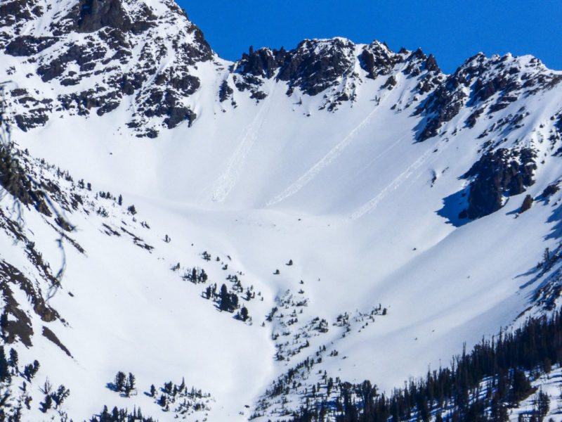
Today got noticeably hotter earlier in the day. A weaker freeze was quickly decomposing on steep E-SE-S-SW facing slopes before noon. Small, natural wet loose avalanches were observed (happening this morning) on E and SE facing terrain in Mill and Prairie Ck drainages. Unfortunately this is only Day 1 of a 5 Day warm-up, so conditions are likely to get worse as meltwater works deeper into the snowpack.
Media/Attachments
Advanced Information
Weather Summary
Cloud Cover:
ClearTemperature:
45-50 F?Wind:
Light , NIt was very warm. It seemed like ambient air temps were in the 40-50 F range for most of the tour. Mid-50s (and rising?) on the truck thermometer driving home. No clouds to be seen, some haze off into the southern Smokys.
Snowpack Observations
We set out to see (suffer through) the emergence of the wet avalanche issues we'll be dealing with for the next 5 days or so. No formal digging but lots of glassing, hand pits, and surface obs. We exited the field by about 2 PM.
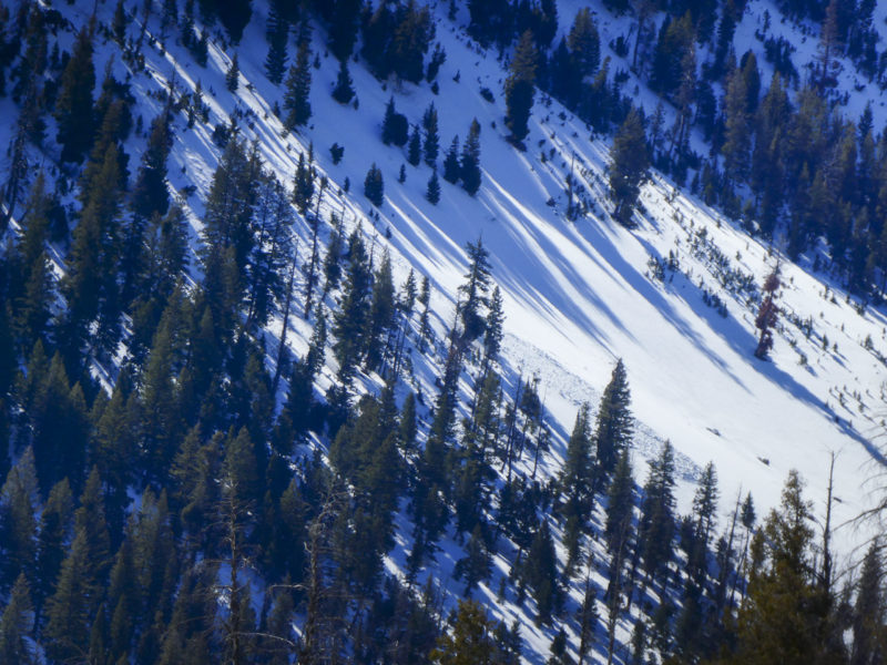
Upper elevations: Wet avalanches were initiating in rocks at upper elevations. They had the appearance of "peelers" that were stripping recent snow off of very steep slopes. Some appeared to gouge deeper as they moved into middle elevation terrain.
Middle elevations: We were able to push small wet loose sluffs on south-facing slopes (9,400') as the matrix of melt-freeze crusts and facets broke down. It was worse on ESE and E where we found fewer and/or thinner crusts and the wet snow was deeper. Super grabby skiing, good sized roller balls. Middle elevations N and NE likely got wet later in the day but I doubt it was moving enough water to be a problem on these aspects with the lack of direct sun.
Lower elevations: Thicker crusts seemed to hold lower elevations together, at least until we left at 2 PM. I'm not sure that would have been the case after 2 PM on SW-W-NW.
Avalanche Problems
| Problem | Location | Distribution | Sensitivity | Size | Comments |
|---|---|---|---|---|---|
 Wet Loose
|
|
Comments: We observed widespread wet loose avalanches on E and SE facing terrain in Mill and Prairie Ck drainages. Some of these happened yesterday but most occurred this morning. Less activity so far in the Boulders, likely due to less recent snow and harder surfaces. |
Terrain Use
We avoided very steep, sun drenched slopes after about 1130 AM.