Pro Field Report
Basic Information
Observation Details
Observation Date:
November 24, 2022Submitted:
November 26, 2022Observer:
SAC - VandenBos (off duty)Zone or Region:
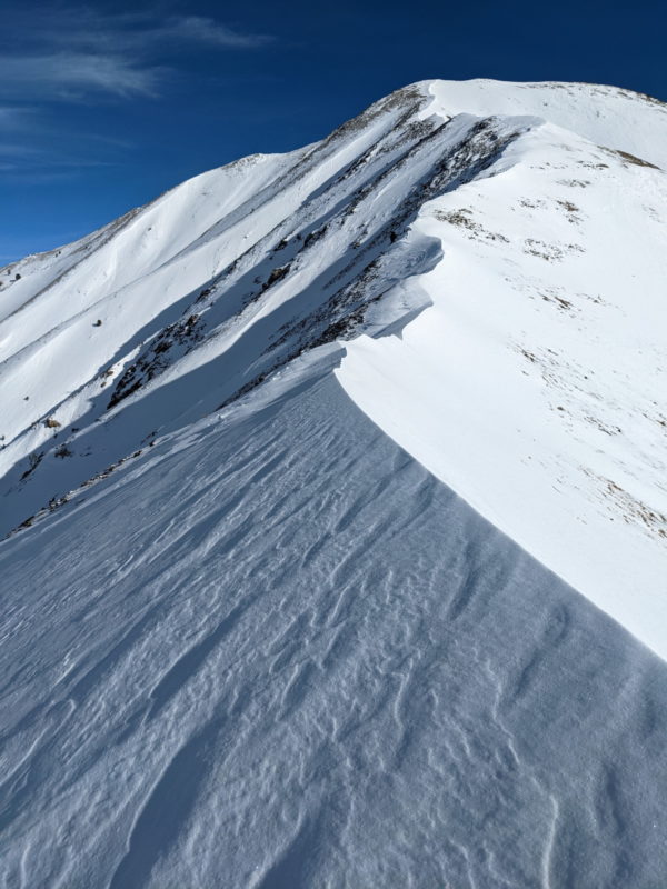
Galena Summit and Eastern MtnsLocation:
Grays Peak (6,500-10,500')Signs of Unstable Snow
Recent Avalanches?
YesCracking?
None ExperiencedCollapsing?
IsolatedMedia/Attachments
Advanced Information
Weather Summary
Cloud Cover:
ClearWind:
Light , NWMostly clear to start the day, with cloud cover increasing in the mid-afternoon. Light winds blowing out of the NW along ridgelines. Above-freezing ambient air temperatures.
Avalanche Observations
| # | Date | Location | Size | Type | Bed Sfc | Depth | Trigger | Photos | Details |
|---|---|---|---|---|---|---|---|---|---|
| 1 |
Nov 18, 2022 (+/- 1 week) |
Grays Peak NW 10300ft |
D2 | HS-Hard Slab | N-Natural | Report |
I observed some hard slab debris below the N/NW face of Grays. Not entirely sure on the timing, but the debris was fairly obvious.
Snowpack Observations
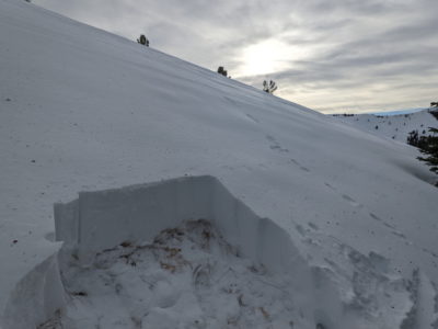
I returned to this area to try to find an intact snowpack with old snow preserved at the ground (got distracted the day before). I dug at 8,800' on a N/NW aspect. It looked like this area had seen a bit of wind during the earlier storms (with loading from the S), but the pack was generally intact:
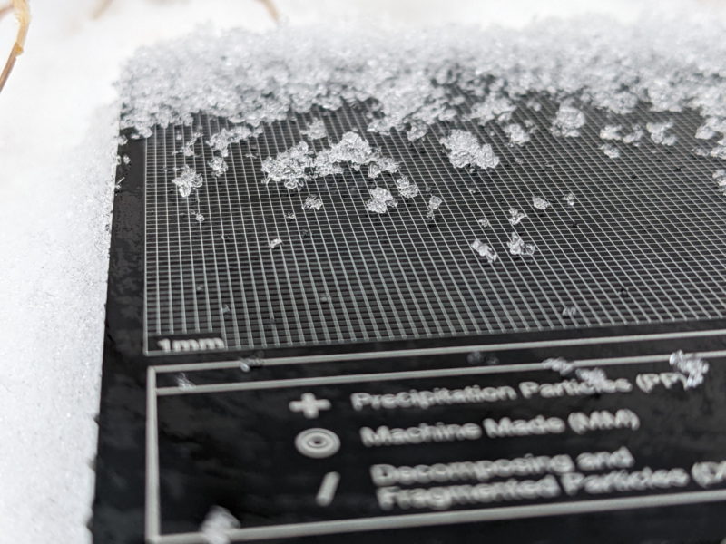
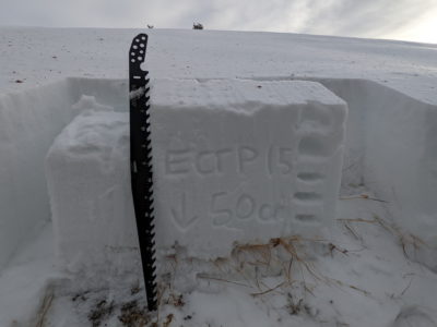
HS=60-65cm, with the bottom 5-15cm of the snowpack composed of snow that fell during the October storms. The upper 50cm of the snowpack accumulated during storms in early November and was fairly homogenous and without obvious weak layers. This snow had faceted significantly over the 2-week drought in November and the slab graded from F- at the top to 4F/4F+ at the base. I performed 3 ECTs here, all of which returned propagating results on top of the weak snow near the ground (ECTP14, 15, and 13). The weak layer was a bit broken up/interrupted by grasses and sage but that didn't prevent fractures from propagating. The failure layer was a 3-4cm interval of 2-4mm DH near the top of the October snow. Grains were cupped and striated, I didn't see any extended chains but suspect you could find them if you rooted around.
Surfaces: today was WARM! Ambient air temps were above freezing throughout my tour, and this was having an effect on snow surfaces. In areas that were getting some sun, a lot of the SH that I'd observed the day before was beginning to lay down. Here, there was moisture at the snow surface and I experienced some skin glopping issues. I suspect that the combo of warm air and sun also helped our marginal crusts (W/SW and E/SE) to wrap around a cover a bit more terrain. I'm unsure if it was warm enough to have a significant impact on surfaces that face away from the sun). Big picture: this micro-heat wave is probably adding to the variability of the snow surface.
Terrain Use
Recently formed, isolated hard slabs were my primary concern, but the prese