Pro Field Report
Basic Information
Observation Details

Observation Date:
December 3, 2022Submitted:
December 4, 2022Observer:
SAC - VandenBos, O'ConnorZone or Region:
Galena Summit and Eastern MtnsLocation:
Baker Creek (6,700-9,100', primarily E-NE-N-NW)Signs of Unstable Snow
Recent Avalanches?
YesCracking?
IsolatedCollapsing?
IsolatedSnow Stability
Stability Rating:
FairConfidence in Rating:
ModerateStability Trend:
SteadyBottom Line
We observed evidence of a widespread avalanche cycle that occurred during the storm. Continued cracking and collapsing of the snowpack, clean, reactive snowpack test results, and poor snowpack structure all indicate that triggering an avalanche on this layer is well within the real of possibility.
Advanced Information
Weather Summary
Cloud Cover:
ClearWind:
CalmNew/Recent Snowfall:
HST settled to 40-45cmClear and calm today, with plenty of snow left for transport, though the sun and the previous winds have somewhat limited this. High clouds began to appear on the western horizon by our exit from the field around 1600.
Avalanche Observations
| # | Date | Location | Size | Type | Bed Sfc | Depth | Trigger | Photos | Details |
|---|---|---|---|---|---|---|---|---|---|
| 2 |
Dec 1, 2022 (+/- 1 day) |
Norton Creek - Baker Creek Drainage NE 9600ft |
D2.5 | HS-Hard Slab | N-Natural | Report | |||
| 30 |
Dec 1, 2022 (+/- 1 day) |
Baker Creek drainage E 8000ft |
D1.5 | SS-Soft Slab | N-Natural | Report | |||
| 1 |
Dec 1, 2022 (+/- 1 day) |
Brodie Gulch - Baker Creek Drainage NE 9600ft |
D2 | SS-Soft Slab | N-Natural | Report | |||
| 3 |
Dec 1, 2022 (+/- 1 day) |
Apollo Creek - Baker Creek Drainage E 9600ft |
D2 | SS-Soft Slab | N-Natural |
|
Report |

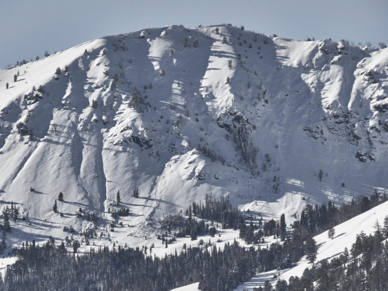
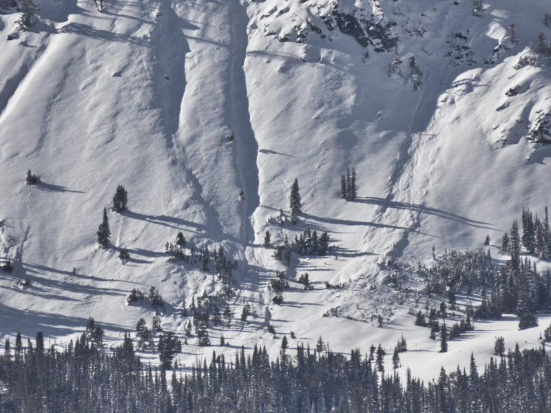
We observed evidence of a widespread avalanche cycle that occurred during the storm. Avalanches had failed at all observed locations from the valley floor to the mountaintops, and on all observed aspects (didn't have a great view of W-facing avalanche terrain in the drainage. Nearly all steep avalanche terrain had slid or had fractured and arrested. While most slides were in the D1-1.5 range, there was plenty of evidence for D2 size slides in bigger terrain where the wind had been at play.
Snowpack Observations
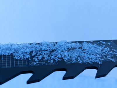
We found a settled 40-45cm of snow from the big storm. At lower elevations, this HS=65-80 cm, climbing higher HS increased to 80-90cm. In areas sheltered from wind and direct sun, we found cold, dry, relatively low-density snow that was settling into a soft slab, F to F- at the top of the slab, grading to 4F near the base of the slab. Underneath this we found weak, 2-3mm facets that produced repeated propagating results in our snowpack test scores. We dug two pits on a N/NW aspect at 8,300' and received ECTPV, ECTP2, ECTP7, and CPST 20/100 and 16/100, both to end. These all failed cleanly and crisply on the 11/27 interface down 40-45 cm. The stack of facets that developed during the mid-November drought was 35-40cm thick, grading from F- at the top to 4F- at the base. Below this we found 5-10cm of remnant snow from October (11/1 interface). This snow was well on its way towards being true depth hoar, with grains 3-4mm in size, cupped, some striated, no observed large chains.
The snow surface is noticeably faceting. I expect that tomorrow's storm will not bond well with this surface, at least in the short term.
Avalanche Problems
| Problem | Location | Distribution | Sensitivity | Size | Comments |
|---|---|---|---|---|---|
 Persistent Slab
|
|
Weak Layer(s):
Nov 27, 2022 (FC)
Comments: Rose is shaded based on where we observed the problem. This layer exists on all slopes that held snow prior to our recent large storm, but the character significantly by aspect. Sensitivity somewhere between stubborn and reactive. |
Terrain Use
We planned to avoid large, open, connected avalanche terrain, particularly where the wind had stiffened the snow surface. We found no reason to change this plan.