Pro Field Report
Basic Information
Observation Details
Observation Date:
January 8, 2023Submitted:
January 8, 2023Observer:
SAC - Jon PreussZone or Region:
Sawtooth and Western Smoky MtnsLocation:
Vat Creek (N-E-S; 6960-9200')Signs of Unstable Snow
Recent Avalanches?
YesCracking?
WidespreadCollapsing?
None ExperiencedBottom Line
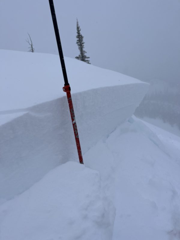
The upper snowpack is riddled with new weak layers. New snow and moderate winds were creating fresh drifts in exposed areas and near ridgelines. Snow pit tests in the mid and lower snowpack resulted in good stability.
Media/Attachments


Advanced Information
Weather Summary
Cloud Cover:
ObscuredWind:
Moderate , SNew/Recent Snowfall:
HN:10-15cmSnow started in Ketchum around 1000hrs and continued for much of the day with only a small break. Winds were gusting to moderate along the ridgelines from S-SE. There was plenty of moving snow.
Avalanche Observations
I kicked off a few cornices which led to fast-moving Dry Loose slides nothing more than D1.
Snowpack Observations
Upper snowpack: Shady slopes have a new crop of buried surface hoar that sits about an inch (3cm) above the rime crust. On the slopes that face the sun, there was a mix of the rime crust with RadRx crust. Both looked bad, the RadRx has small chains of near surface facets around it.
Mid snowpack: I found no signs of instability associated with 12/19 or 12/8 on shady slopes. The snowpack was rounding and firm (1F-P). The sunny slopes have a series of crusts, but none of the facets between them could produce results in stability tests.
Basement: The November snow was moist on all aspects. It was the strongest I have seen it yet in a snowpit that was 182cm deep (sheltered North, 9000'). The overlying "slab" was pencil hard for much of the lower snowpack.


Avalanche Problems
| Problem | Location | Distribution | Sensitivity | Size | Comments |
|---|---|---|---|---|---|
 Persistent Slab
|
|
Layer Depth/Date: 15-20cm Comments: Rose shading for observed terrain today. PWL is on recently buried Surface Hoar and Near Surface Facets (crust on souths). Sensitivity and Size will increase with incoming storm. |
|||
 Wind Slab
|
|
Layer Depth/Date: 30-45cm Comments: Lots of cracking today while walking along the ridge. |
The weak new layers were showing CT2 (SC) and ECTN5 in test results. I observed these layers on both Sunny and shady slopes. Both the surface hoar and RadRx crust aren't likely to behave well with Monday's storm. Today there wasn't enough snow on top of the weak layers to show propagation, but if tomorrow's storm adds another foot of snow, it should be game on.
Terrain Use
Solo travel day. Avoided avalanche terrain.