November – December 11, 2018
Snow arrived to mountain locations in early October. While servicing a weather station at 9,200’ near Galena Summit on October 25th, SAC forecasters observed ~4” of compact melt-freeze layers and facets in shaded areas while sunnier slopes remained clear of snow. Since then, our snowpack has evolved through three notable snow events highlighted in Figure 1 below.
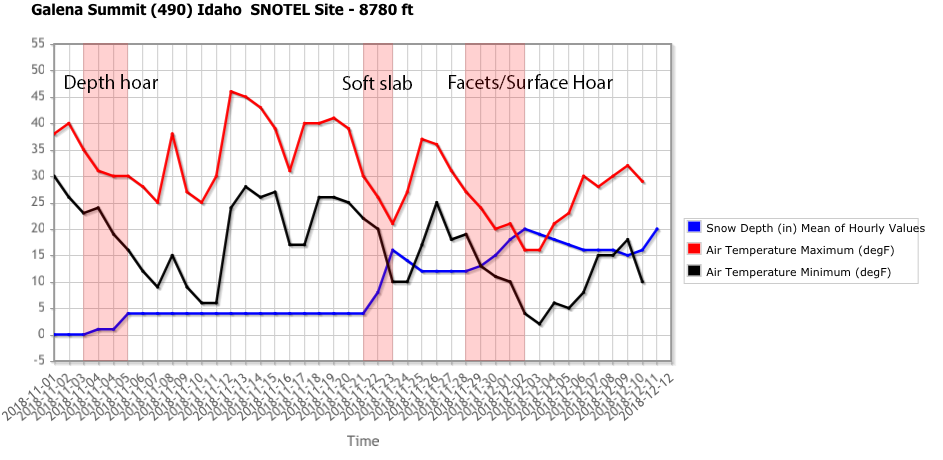
Figure 1: Snow depth and air temperature data from a representative Snotel site near Galena.Pass in the Smoky Mountains. The red highlighted areas show notable snow events, and the labels correspond to the current character of these layers from recent observations.
The Thanksgiving snow event (labeled “Soft slab” in Figure 1) spanned 2-days dropping anywhere from 6-16” of snow favoring the western Smoky Mountains, Galena Summit and the Sawtooths. Only a few avalanches were reported (see Image 2 below) but poor visibility during this prolonged event surely played a role. In the following two weeks, areas that harbored depth hoar near the ground have been extremely touchy and talkative. Observations from all forecast zones report poor snowpack test scores, widespread crackingand whumpfs that propagated up to one-hundred feet and shook snow out of trees.