Pro Field Report
Basic Information
Observation Details
Observation Date:
March 10, 2023Submitted:
March 11, 2023Observer:
SAC - Scott SavageZone or Region:
Soldier and Wood River Valley MtnsLocation:
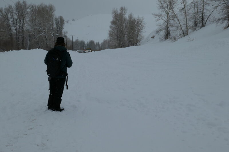
driving and glassing Hailey-Eagle Creek (many lower and middle elevation areas)Signs of Unstable Snow
Recent Avalanches?
YesCracking?
None ExperiencedCollapsing?
None ExperiencedSnow Stability
Stability Rating:
Very PoorConfidence in Rating:
HighStability Trend:
SteadyBottom Line
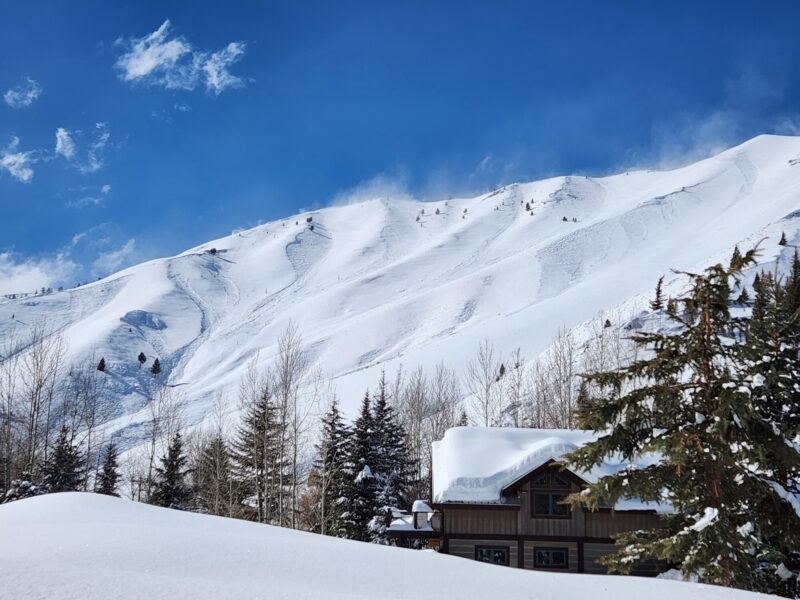
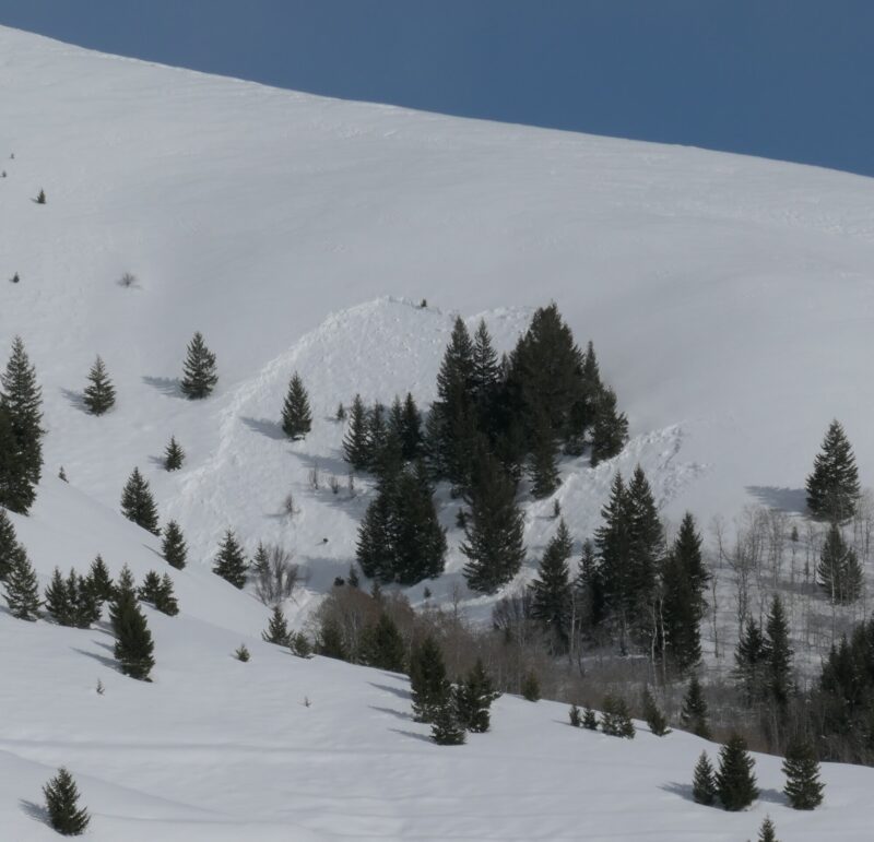
Today was one of the most widespread avalanche cycles I've ever seen (Wood River Valley - Hailey to Eagle Creek). I saw over 100 natural avalanches, despite the limited visibility for most of the day. Avalanches damaged 2 houses, stuck approximately 10 structures, buried both lanes of HWY75, and blocked the Big Wood River in several places.
Media/Attachments
Advanced Information
Weather Summary
Cloud Cover:
Mostly CloudyTemperature:
20s and 30s FWind:
Extreme , WNew/Recent Snowfall:
About 1.5" SWE, 12-15" HSTSnowing hard in the morning with rain in Hailey after about 11 AM. Strong S-SE winds until they bumped up to extreme and shifted W after noon. Wind shift/increase coincided with the end of precipitation. Winds were still transporting snow at 4 PM, but not as much as in the noon-3 PM timeframe.
Avalanche Observations
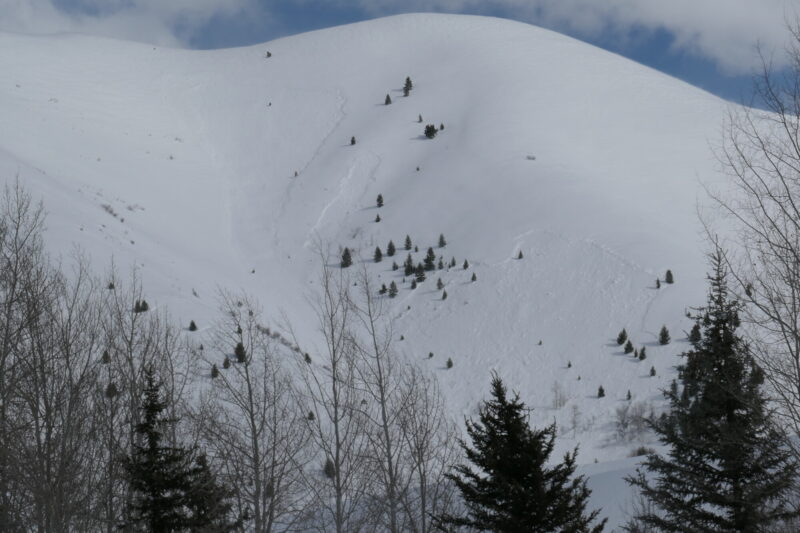
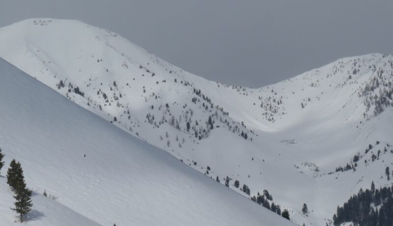
Will add specific avalanche observations and entries over the weekend. The majority of the activity I observed was D2-2.5, NW-N-NE-E-SE aspects, lower and middle elevations, storm slabs and persistent slabs failing on February facets and crust+facet combinations as well as within the low density snow that fell Wed-Thurs.
Snowpack Observations
None performed.
Avalanche Problems
| Problem | Location | Distribution | Sensitivity | Size | Comments |
|---|---|---|---|---|---|
 Persistent Slab
|
|
Weak Layer(s):
Feb 26, 2023 (FCsf)
Feb 18, 2023 (FCsf)
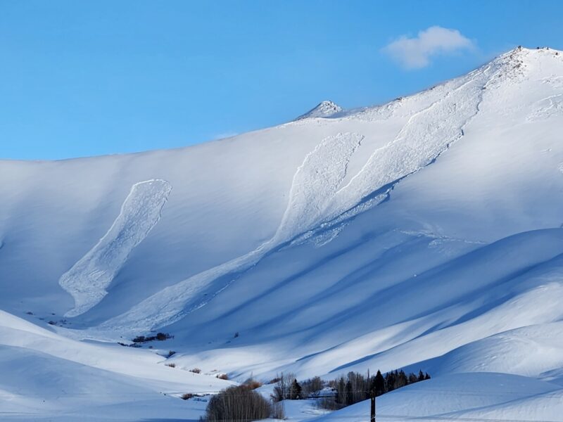
Comments: Shaded area is where I observed the bulk of the persistent slabs that failed. I did not see much upper elevation terrain, but there were D2-D3 slides in the Lake Ck headwall (some of the only upper elevation terrain I observed). |
|||
 Storm Slab
|
|
Layer Depth/Date: 20-40cm Comments: Widespread small avalanches and cracking, especially this morning. This problem seemed to be fleeting though, decreasing significantly by afternoon. I did not include upper elevations because I observed very little upper elevation terrain. |
Terrain Use
I was spooked driving underneath large paths. I watched a small (D1.5-D2) slide release above Penny Lake while I was driving underneath it. I parked in a safe place and watched that area for about 20 minutes before witnessing a significant D2-D2.5 avalanche run full track in that area.